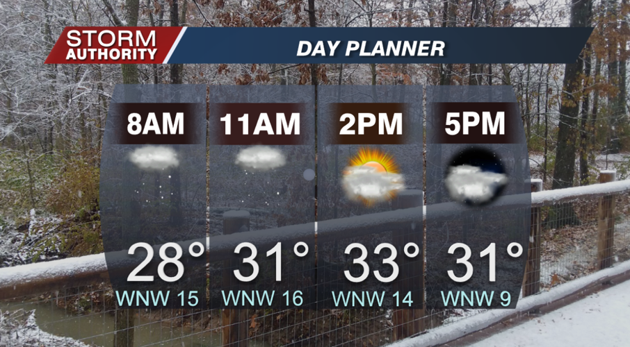
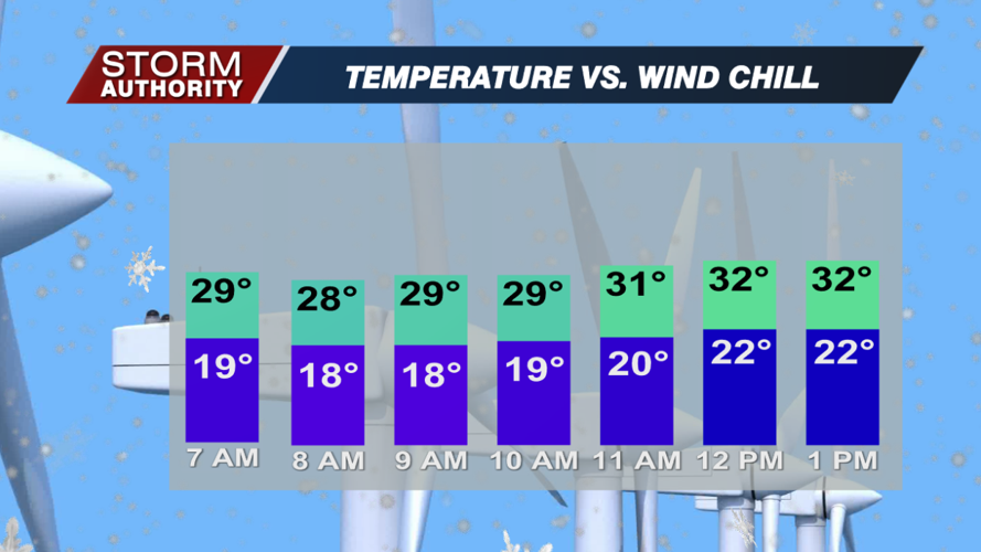

A passing cold front overnight sent temperatures plummeting back below freezing! Lake-effect flurries and snow showers have coated the ground in spots, and scattered flurries continue this morning. Those flurries gradually taper by afternoon, but the chill doesn't go anywhere. Even with some peeks of sun, highs will struggle to rise past the lower 30s. The wind chill will hover in the lower 20s thanks to breezy winds around 10-20 mph.


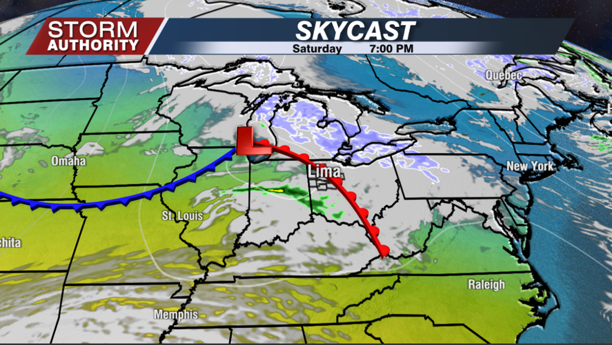
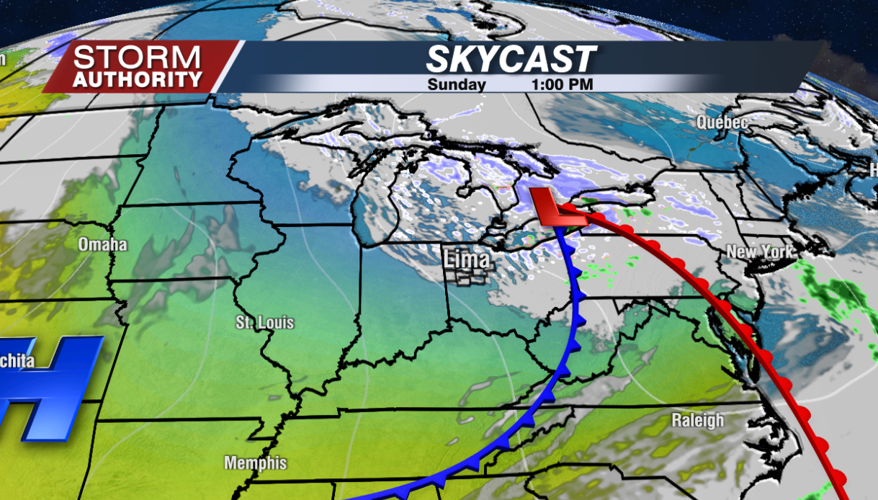
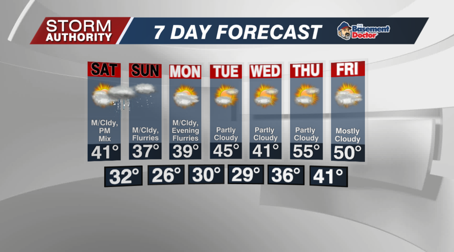
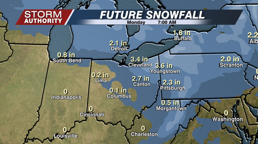
No significant weather impacts are expected locally during the weekend, but we do have a clipper system set to bring some rain and snow shower activity by Saturday afternoon and night. Data does suggest a wave of sticking snow will ride just to our north across southern Michigan (possibly into Toledo) then east into northeast Ohio. Cleveland could get a few inches of snow over the weekend, so keep this in mind in traveling there. Sunday looks cold and mainly dry, but there will be a few scattered flurries around. Highs should reach around 40° Saturday, then the upper 30s Sunday.


Overall, a rather uneventful stretch of weather is expected next week. One more clipper-type system could bring down some rain and snow shower chances late Monday, then the rest of the week looks dry. A brief, robust warming trend could send highs deep into the 50s for next Thursday. It's a great way to start December, but all signs point to a much colder change quickly returning by the following weekend.

