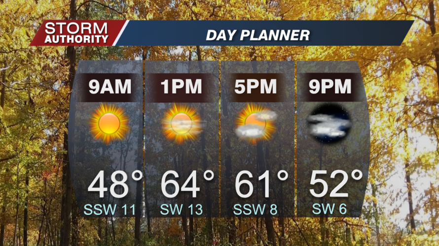
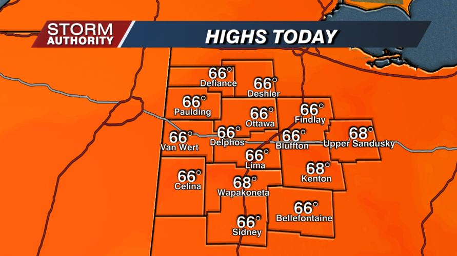

Our Monday is starting off nice and clear with temperatures in the 40s. Another fantastic fall day awaits with sunshine and highs soaring into the middle 60s. Winds will become a bit breezy, southwest at 10 to 20 mph.


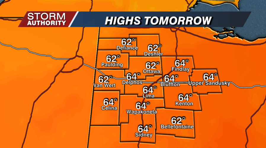
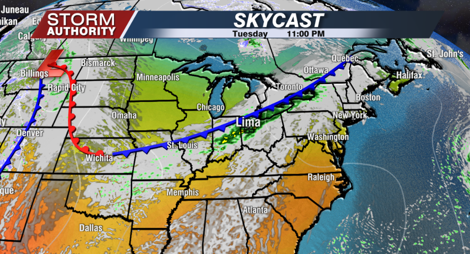
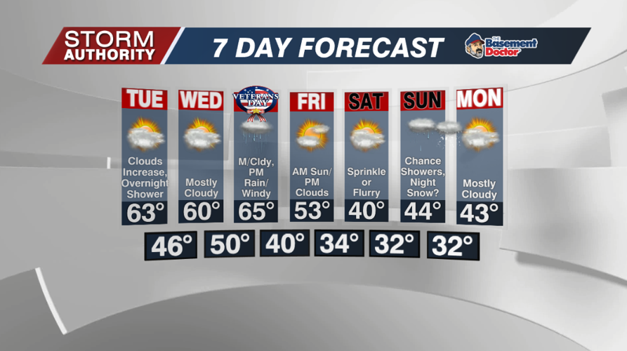
Overall, a decent weather pattern through midweek. The one notable change will be more cloud coverage for Tuesday and Wednesday, but staying dry during the days. A few showers are possible Tuesday night. Daily highs should generally run in the lower 60s.


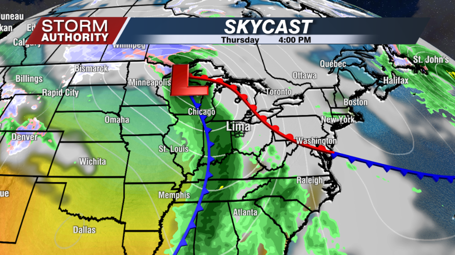
A stronger system will begin impacting our region Thursday. Winds will pick up significantly, possibly gusting over 40mph from Thursday afternoon through Thursday night. Along with the wind, a band of rain showers is forecast to arrive late Thursday afternoon through Thursday night. Highs should still hit the middle 60s just before the rain arrives.

A sharply colder air mass arrives for the weekend. Highs fall from the low 50s Friday to around 40° Saturday! Friday appears dry, then a few flurries or sprinkles are possible Saturday. On Sunday, a secondary system may dive in from the northwest. This could bring a few showers with the chance for a mix or change to some wet snow by Sunday night.

