
Our Monday is off to a cold and clear start. The weather pattern is relatively quiet ahead with dry weather lasting through Thursday. A series of systems across the Canadian border will cause our temperatures to fluctuate, but most days will run warmer than normal.
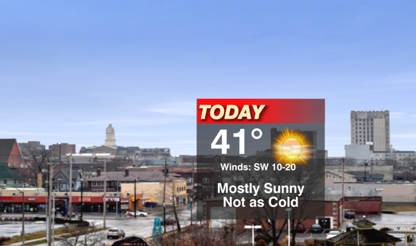
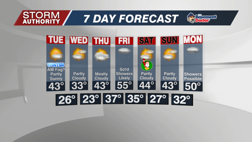
A southwest breeze means a warming trend is in store today. After barely cracking freezing Sunday, most areas should around or just above 40° for the high. Grab the sunglasses, there will be no shortage of sunshine!

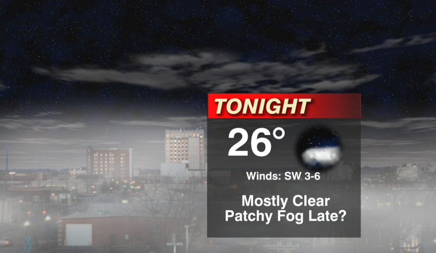
Tonight is another chilly night. Winds are expected to go calm toward daybreak Tuesday, and that could allow for a few patches of fog.

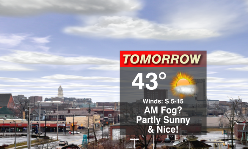
Tuesday is another nice day with some sunshine and highs in the lower 40s.

Expect a solid 10° drop in temperatures for Wednesday due to the passage of a cold front. Highs will struggle to reach above freezing, but at least the sun will be out!

Temperatures will quickly jump above normal again late week. Christmas Eve looks very mild with highs in the 50s, but a strong possibility of showers around. Right now, indications are that dry weather returns for Christmas Day with some sunshine and highs in the 40s. Stay tuned as the timing of this system could change.


