


Monday AM Update 1/31/22:
The week starts quiet with a nice warming trend! A sunny Monday ahead as highs reach near the freezing mark. Even warmer air arrives Tuesday with highs reaching 50° under partly cloudy skies.
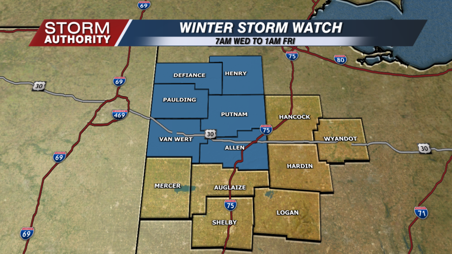
It all goes downhill from there. In fact, a major winter storm looks to directly impact our area middle to late week. The National Weather Service has already placed Lima and points north and west in a winter storm watch. This is to raise the awareness that impactful wintry weather is looking likely this week. This update will dive into the latest time-line and thinking:
The event starts as rain Tuesday night. On Wednesday, colder air will allow our north and western zones to see a mix of sleet, freezing rain, and snow. Right now, Lima looks to stay mostly rain during the daylight hours of Wednesday.
Wednesday night begins the areawide wintry issues as temperatures plummet into the 20s. Rain goes over to a mixture of sleet, freezing rain, and snow. The snow will be most likely north of U.S. 30.
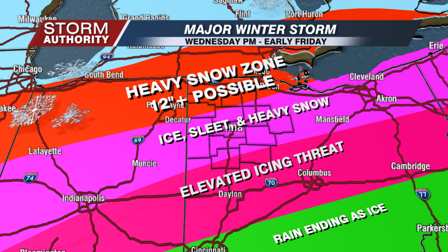
Thursday, the snow and icy mix will continue across the area, gradually going over to all snow. Heavy snowfall totals will be possible.
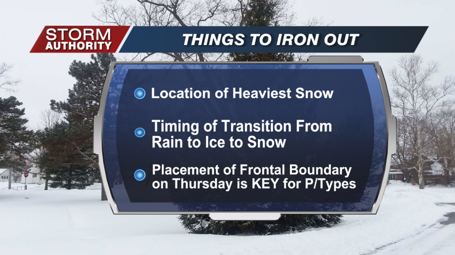
There is still uncertainty in the a)location of heaviest snow, b)timing of the rain/ice/snow transitions, and c)placement of the frontal boundary on Thursday. This will be KEY regarding the types of precipitation.
It still appears most of the area stands the threat of seeing significant snow totals. The highest confidence of that is north, where we are seeing signals for at least a foot. We are not placing totals for Lima yet due to the concerns of sleet and icing. How much of that and low long it lingers will greatly impact our snow totals. Most of the "snow" side of the event for Lima will be taking place Thursday. There is an elevated icing concern for parts of the state, especially central and southern Ohio.
The forecast will continue to evolve, and we will undoubtedly get more specific as the system approaches. We will keep you updated on air and social media!
