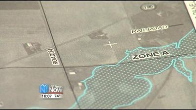
Preliminary reports for the flood insurance rate maps have been released for Putnam County. The Federal Emergency Management Agency along with the Ohio Department of Natural Resources held a public meeting at the Office of Public Safety. Residents were invited to view flood zones and assess how they have changed over time. With the Blanchard River and area’s of low lying land flooding is always a concern for developers, businesses and residence. The ODNR says the flood zones have actually decreased since the last release of information in the early 90’s because of more accurate mapping.
Maps can be viewed at the Ottawa Municipal Building or the Putnam County Commissioners Office. If residents have questions they can contact the ODNR Flood Plain Management Program.


