
A potent clipper system is bringing gusty winds and a band of rain showers to the area, with much of the shower activity taking place this afternoon. Certainly a raw afternoon ahead with those wind gusts up to 30mph.
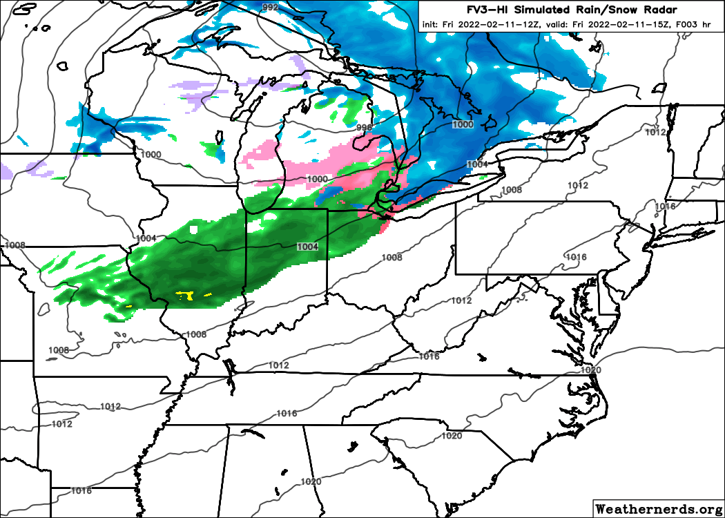
Map courtesy of weathernerds.org
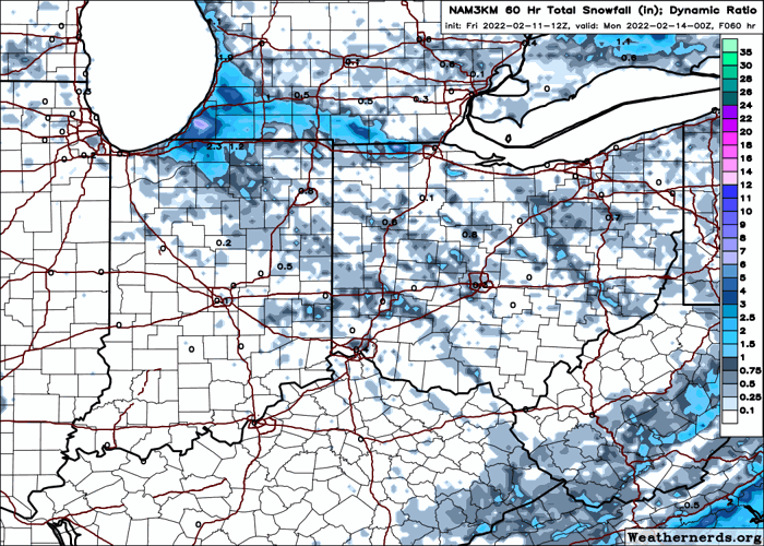
Shower coverage turns spotty this evening. An arctic front will arrive after midnight and cause temperatures to plummet. Scattered flurries are likely, but little to no snow accumulation. Some slick spots could develop with remaining moisture freezing into icy patches.
A cold weekend with snow flurries in the air, but accumulations will be minimal. A few bursts of snow could drop light, scattered accumulations generally a half-inch or less, especially Saturday night through Sunday night. Highs will run in the middle 20s with lows in the teens to isolated single digits.

Map courtesy of weathernerds.org
The cold lingers through Monday, then big changes! After highs of 26-30° Monday, a rebound to 35-40° Tuesday. A howling southwest wind on Wednesday will boost numbers to the 51-55° range!!
While our area warms midweek, a blast of arctic air will be diving into the upper Midwest. This massive temperature gradient will fuel a storm system with ample moisture, expected to ride from the Southern Plains to the Great Lakes region. By Thursday, temperatures could range from 60° in Columbus, Ohio to 18° in Madison, Wisconsin! Most of the data keeps northwest Ohio in the warm sector with a heavy rain threat developing on Thursday. By Thursday night, our temperatures could plummet with a transition to some wintry weather before the storm exits. This storm is a week out, so there will be changes as it gets closer. If the cold air ends up being stronger, a further south storm would bring more ice/snow concerns our way. On the contrary, a track even further north than current guidance would bring the possibility of severe storms. As of Friday morning, the forecast calls for rain with only a touch of winter weather as the storm pulls away. Stay tuned over the coming days for any changes.
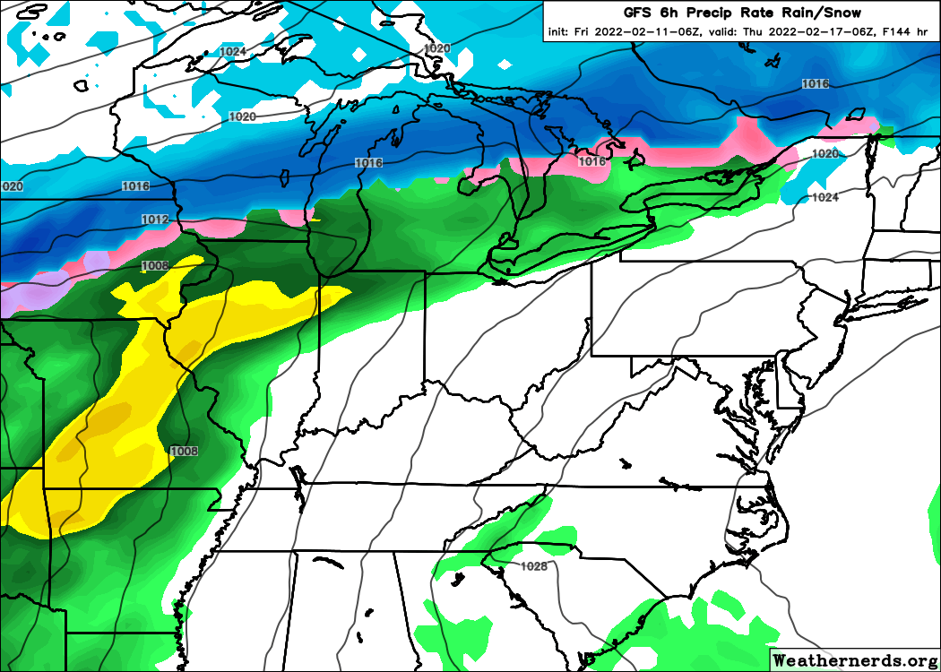
Map courtesy of weathernerds.org
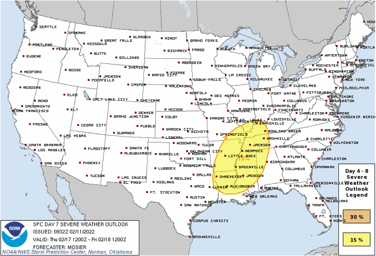
Believe it or not, the Storm Prediction Center is already highlighting portions of the Mississippi River Valley (up to southwest Indiana) for the risk of severe weather next Thursday.

NOAA Storm Prediction Center spc.noaa.gov
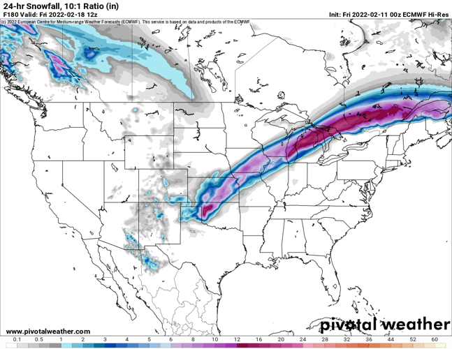
On the northern side of the storm, a stripe of significant snows will be possible. Again, too early to know the exact track, but early forecasts favor Kansas, Iowa to northern Illinois, Wisconsin, Michigan. It could end up as close as Chicago.

Map courtesy of pivotalweather.com
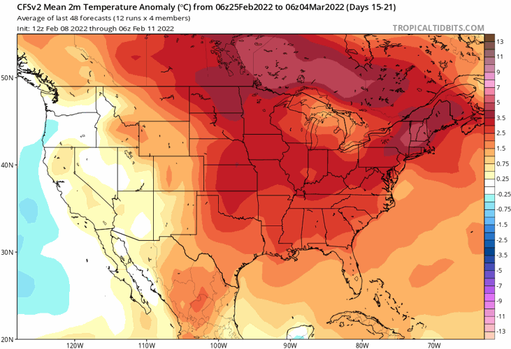
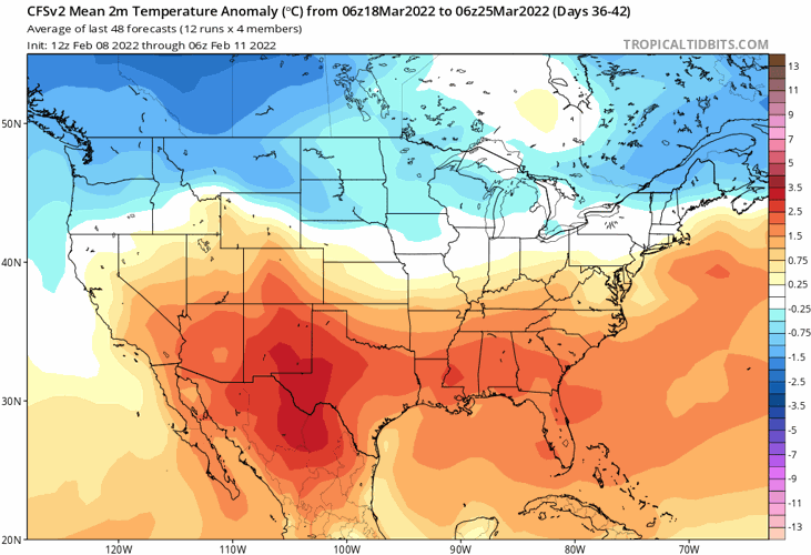
It turns cold again for a couple of days, then the pattern looks to warm once again. This go around, a "sustained" period of well above normal temperatures is showing up for the final full week of February. We could have several days flirting with 50° if this outlook holds. Not only does it look warm for late February, but the long-range models show the milder than normal air dominating through the first part of March. The graphic below shows the temperature outlook from February 25th to March 4th...much of the country to run above normal.

Map courtesy of TropicalTidbits.com
Even in an overall warm pattern, don't forget that there can still be random, brief hits of snow and ice. This will however make it more difficult for snow to occur. There are signs of some cooler air returning in mid-March which would increase the risk of winter weather hits during that time. The European and Climate Forecast System models suggest a mid-March "pullback" in the warmth.

Map courtesy of TropicalTidbits.com
