

LIMA, OH (WLIO) - Winter is coming and a stubborn La Niña continues to take hold. Meteorologist Nathan Kitchens discusses how that could influence our winter.

It's that time of year again when we look into the weather crystal ball to see how cold, mild, or snowy the upcoming winter will be.
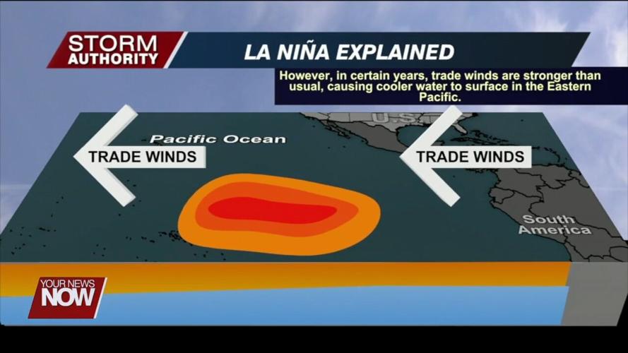
While it remains impossible to get into specifics, we can identify certain drivers that will influence our long-range weather. One of those factors includes ocean temperatures in the equator regions of the pacific ocean. Water temperatures in this area remain cooler than normal. This acts to cool the air above it and impact the jet stream pattern. This phenomenon will typically create an active and colder winter across the northern tier of states, with warm and dry weather along the gulf coast.

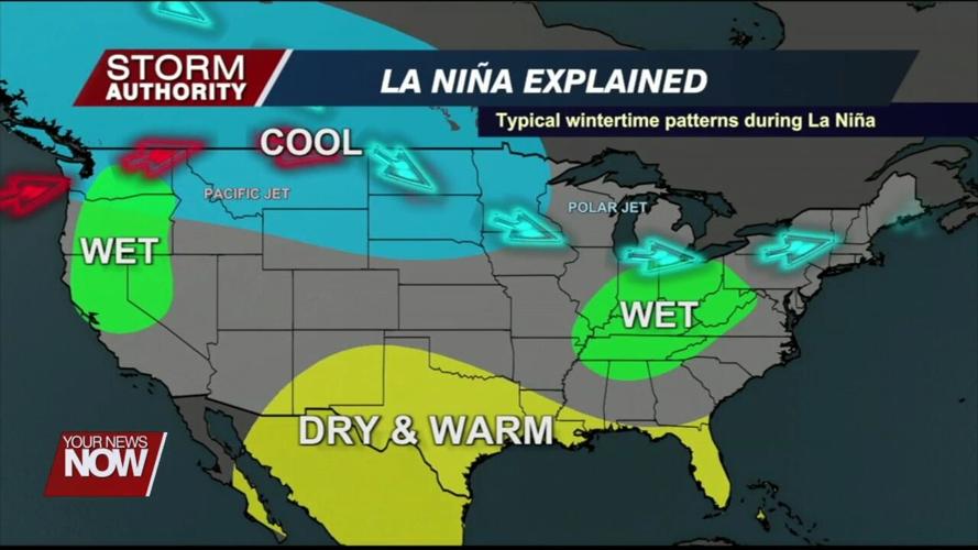
We often see phasing of the northern and southern jet streams in the Ohio Valley region in this scenario. This tends to produce above-normal moisture in our area. However, active does not necessarily mean being snowy. A ridge of warmer air tends to pop up frequently to our southeast in these winters, which can create messy winter storms.

"When we might expect more of like a snow event, you can tend to get more of those precipitation types to bleed in because we don't have enough or a way to hold the cold air in as much," explained Chris Roller, National Weather Service Northern Indiana Meteorologist.
What makes this winter unique is that it's our third consecutive La Niña pattern. We only have two other times since 1950 when this took place. Looking back at these years, the intensity of La Niña was key.
"In the weaker La Niña, we tend to see the snow on the front end, and we actually tend to see the weaker snow in the back end of a weak La Niña," added Roller.
This year's La Niña is projected to be on the weaker side which could give us a hedge toward a front-loaded winter in regard to snowfall. This means a higher amount of snow may occur in December and January.
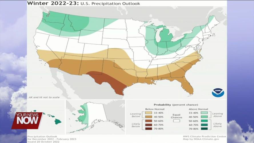
The current NOAA winter outlook shows a lacking signal for temperatures to sway either side of normal, but a higher chance for precipitation to end up above average.


