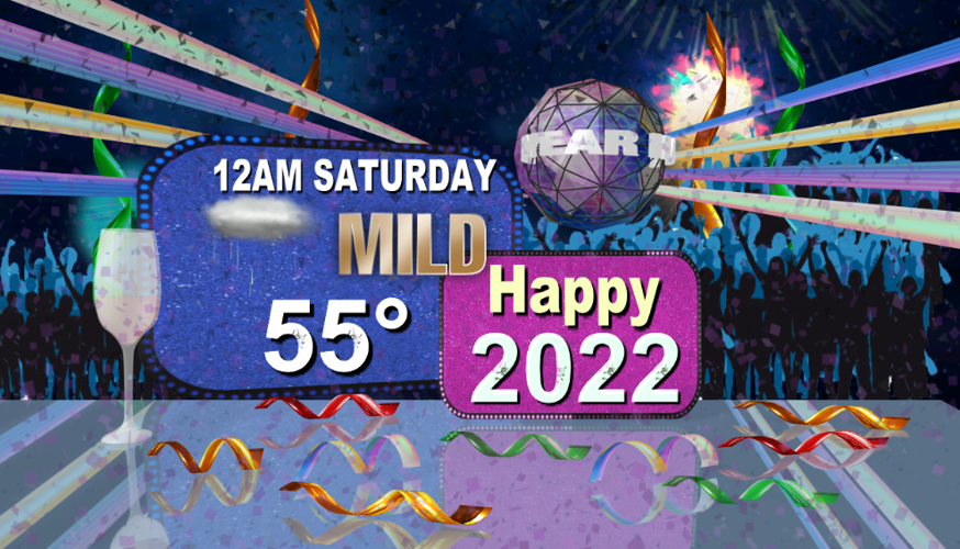


Happy New Year's Eve, everyone! The weather has felt very "Seattle-like" this week with gloomy skies and rain or drizzle on a daily basis! That gloomy theme continues today with a few patches of mist, but the afternoon should trend "mostly" dry. Highs will surge closer to 50° by sunset.
Temperatures will actually rise tonight, edging toward the middle 50s as we say hello to the new year! The evening will be mild but damp with a few showers around.
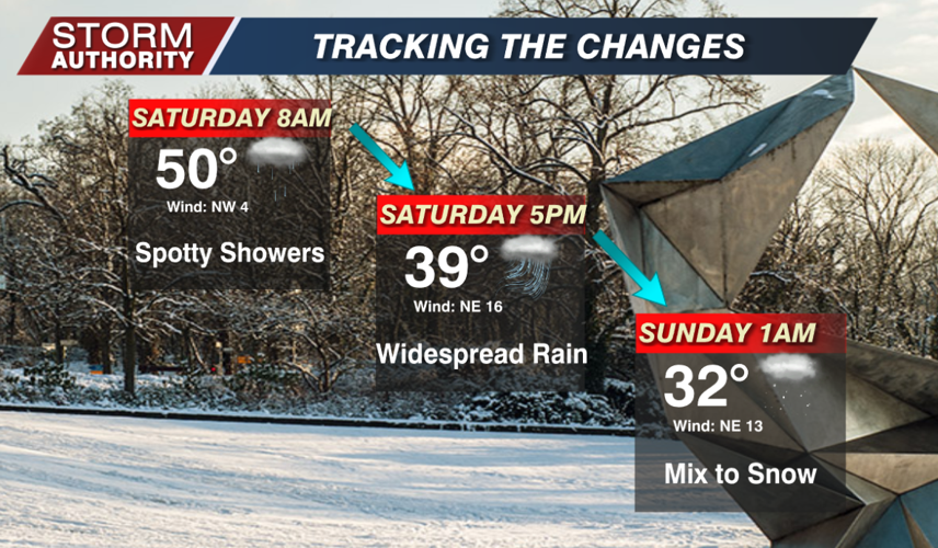
The first day of 2022 will be active. The day starts off mild with just a few showers. Gradually, temperatures will fall through the day. Expect the bulk of the steady rain to arrive for the afternoon hours.
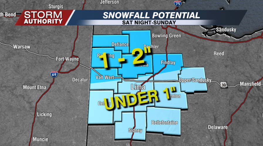
Showers will transition to a light wintry mix Saturday evening and night from northwest to southeast. Eventually, everything should transition to scattered snow showers heading into Sunday morning. Snow showers will taper and end by midday. While not a big winter event, roadways likely become slick and hazardous late Saturday night through Sunday morning, so plan accordingly. Confidence is still rather low regarding snow totals. For now, our initial call will be 1-2" of snow across nearly the northern half of the area, with under 1" for the Lima and area and points south. Check back for further updates!
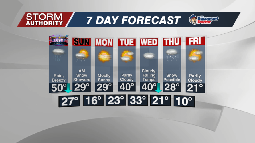
Next week starts off quite cold, briefly turns milder, then gets very cold mid to late week! A decent chance to see our coldest temperatures since last winter. However, it appears another quick flip to some milder air could arrive next weekend. There may be some snow on Thursday, but it is way too far out to get specific.
