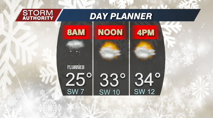
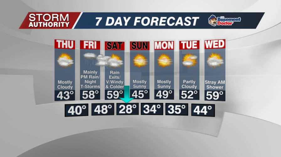


Flurries and very chilly conditions to start off this Wednesday. Expect a slight warm-up as highs return to the middle 30s. Skies will be mostly cloudy skies with a few flurries through the day.
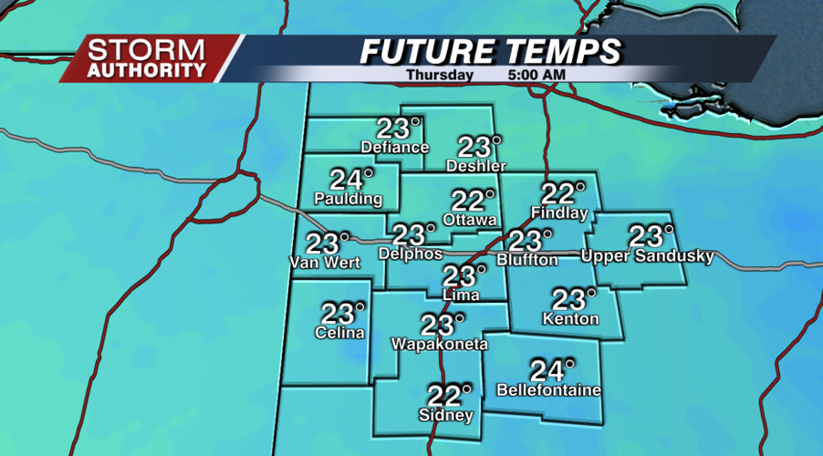
One more cold night ahead as lows settle into the lower 20s for many spots by Thursday morning. Tonight looks quiet with partly cloudy skies.
Thursday looks cloudy, dry, and a bit warmer. A breezy southeast wind will push temperatures back into the lower half of the 40s for the afternoon.
The Friday to Saturday period is one to pay very close attention to as erratic swings will occur in our weather! Here is a full breakdown of what to expect:
Shower activity gradually increases Friday afternoon and evening with rising temperatures.
Widespread rains Friday night with the possibility of thunderstorms.
The Storm Prediction Center has a marginal severe risk around Dayton to Cincinnati, but we'll monitor for the possibility of a north shift in the severe risk. IF severe weather shifts our way, the primary concern is strong wind.
Although daytime temperatures will struggle in the 40s to near 50 Friday, expect temperatures to skyrocket to the 60s Friday night into early Saturday. A record high isn't off the table predawn Saturday!
Temperatures plunge RAPIDLY on Saturday! The 60° warmth at sunrise gives way to 30s by the second half of the day.
Very windy Saturday with gusts potentially around 50mph.
Finally, everything calms down Sunday with sunny skies and highs in the 40s! Beautiful weather conditions arrive for the first half of next week with a warming trend and generally dry weather. Highs could hit 60° by the middle of the week which is near record warmth for mid-December!


