
Wednesday, January 26, 2022:
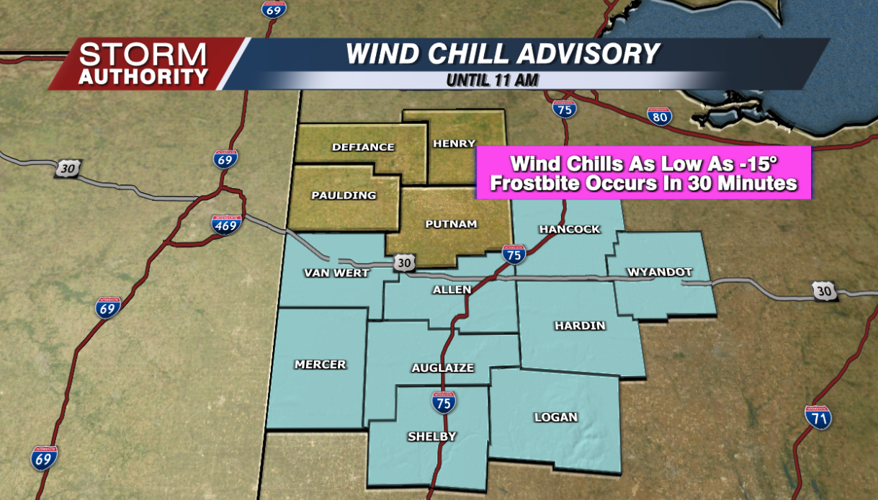
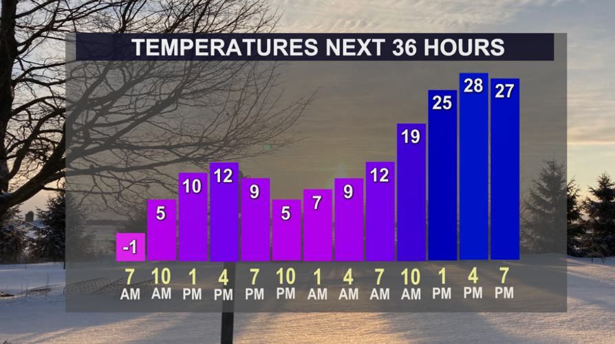
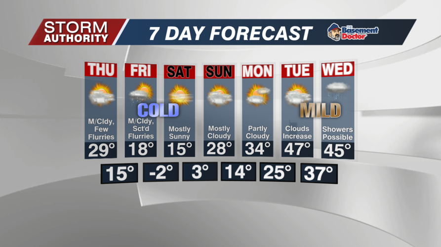
Temperatures dipped below zero in many areas this morning, the coldest morning since February 17, 2021! A light breeze around 5-10mph has dropped wind chills to the negative teens. As a result, a wind chill advisory remains in effect until 11AM. Temperatures reach the lower to middle teens for the afternoon high, but at least there will be sunshine.

The arctic air will briefly ease its grip before returning in full force to start the weekend. Lows tonight settle to the lower single digits early on, then jump into the teens by sunrise on Thursday. Highs will jump to near 30° tomorrow with increasing clouds and breezier southwest winds.

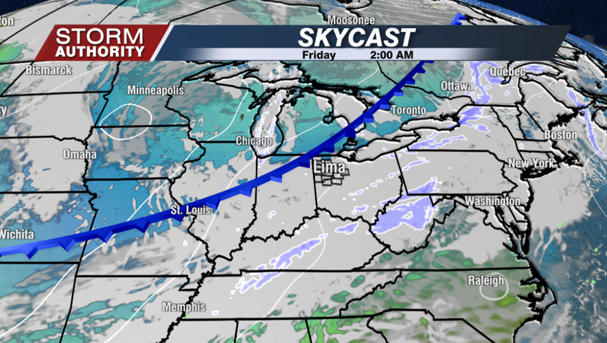
A cold front drops through Thursday night into the day Friday. Scattered snow flurries are likely as it passes, but accumulations look minor at best. Any accumulations look under a half-inch, and some spots will only see trace amounts. This could cause a few slick spots for Friday morning's commute.

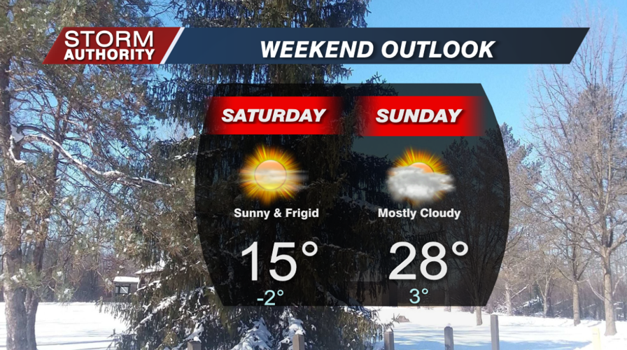
The start of the weekend looks frigid! Lows are forecast to once again fall below 0° Saturday morning. The weekend does look dry and quiet for any travel plans locally.

Next week looks like quite a weather week unfolding. A shift in the jet stream will pump in substantially milder air by Tuesday and Wednesday. A storm system looks to deliver rain showers by Wednesday. There are signs that cold air may return later next week as moisture continues to pump in along a frontal zone. This would need to be watched for a winter weather threat, but confidence is low at this distance.


