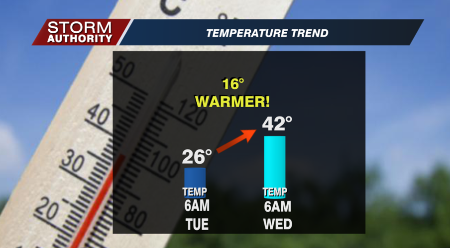
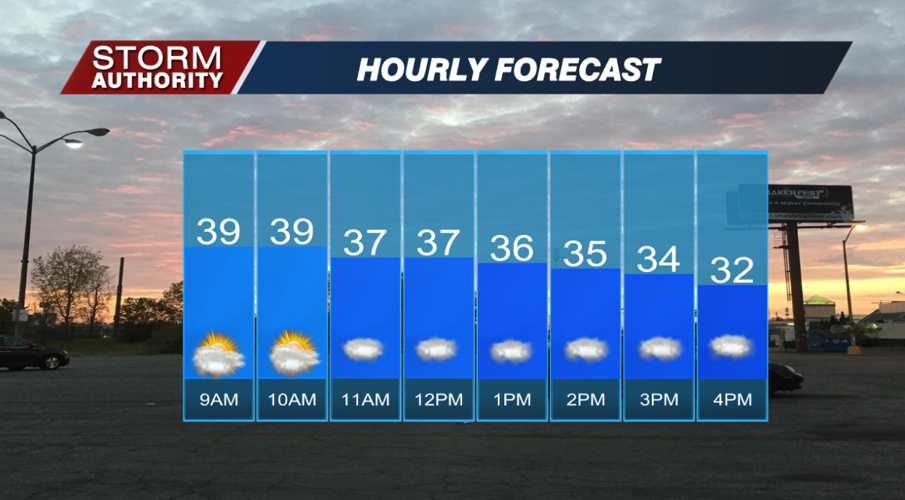


Wednesday, January 19, 2022:
A "balmy" morning for January with temperatures near 40°. The warmth has been funneled in by breezy southwest winds ahead of a cold front. Temperatures will fall for the afternoon after the front passes around midday. By 5PM, areawide temperatures should drop below freezing. Skies will turn mostly cloudy, but precipitation chances are low outside of a few sprinkles or a flurry.


Very cold tonight as breezy north winds pull down arctic air. Expect middle teens for the low, but wind chills closer to 5° to wake up on Thursday!
The story is dry and cold for late week. Partly cloudy Thursday, then lots of sunshine for Friday. A couple of weak disturbances will provide snow shower chances on Sunday and Monday. We could end up with minor accumulations. We may see additional snow chances pop up next week as time gets closer. Expect a very cold pattern with highs in the 20s and lows in the 10s consistently through late week. This will be the longest stretch below freezing since last February.


