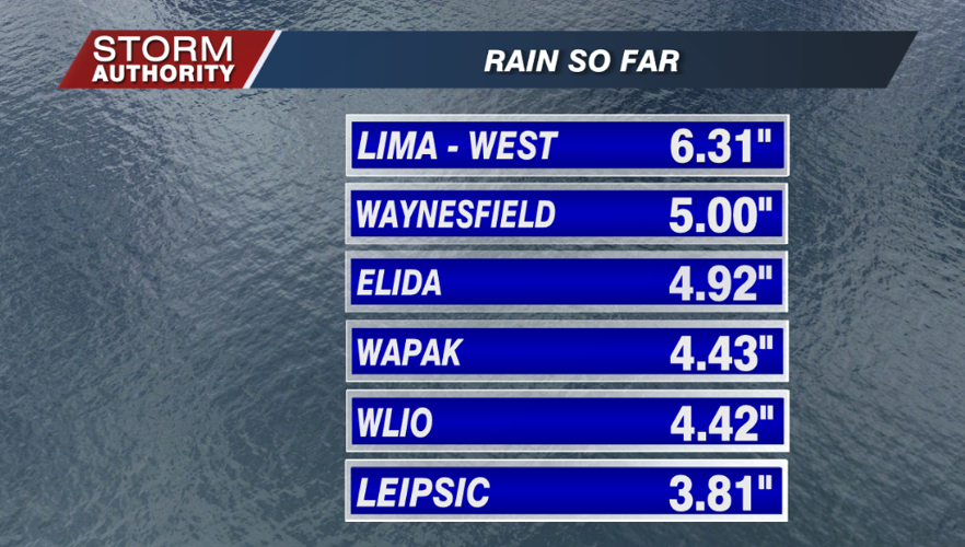

Rain totals over the past 36 hours have reached 3-6" for a large portion of the area. The saving grace has been the antecedent dry ground and low stream levels which have kept flooding issues minimal. If not, this would of caused a lot of problems. Here is a sampling of totals from area weather observers.

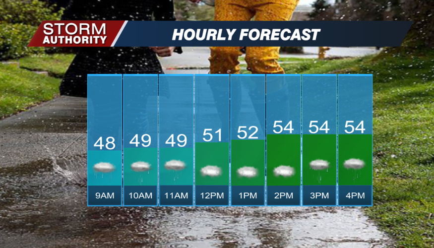
TODAY: The flood watch has now expired, and the flood warning that was previously issued near Kalida for the Ottawa River was cancelled. The new forecast shows the waters staying below flood stage. Areas of drizzle and light rain will plague us much of the morning. Drier weather should develop by afternoon as the shower activity becomes spotty. Some sun may even break out south of Lima later today. Expect temperatures much cooler than average, only hitting the middle 50s. Winds remain breezy out of the west at 10-25 mph.

TONIGHT: Expect a mainly dry evening, with clouds giving way to clear skies overnight. Lows will settle in the middle 40s.
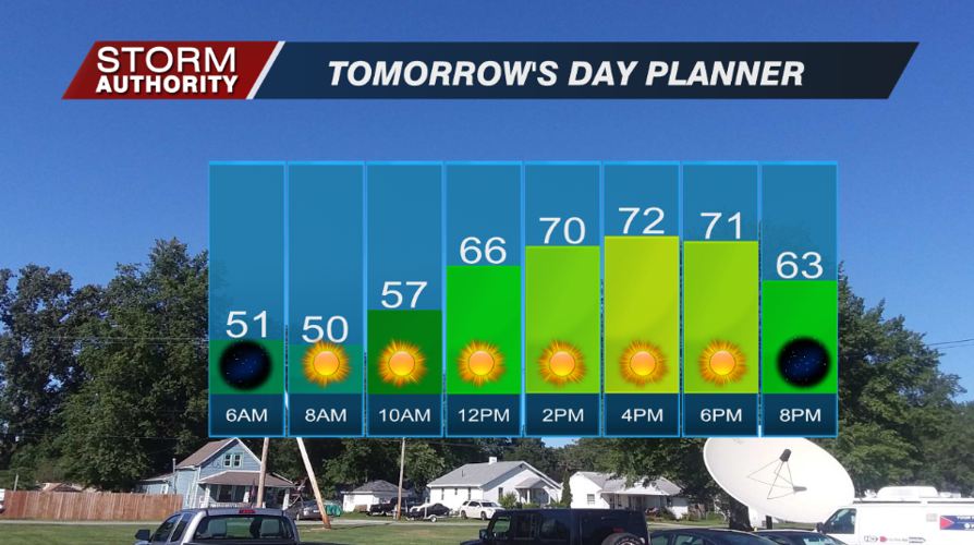
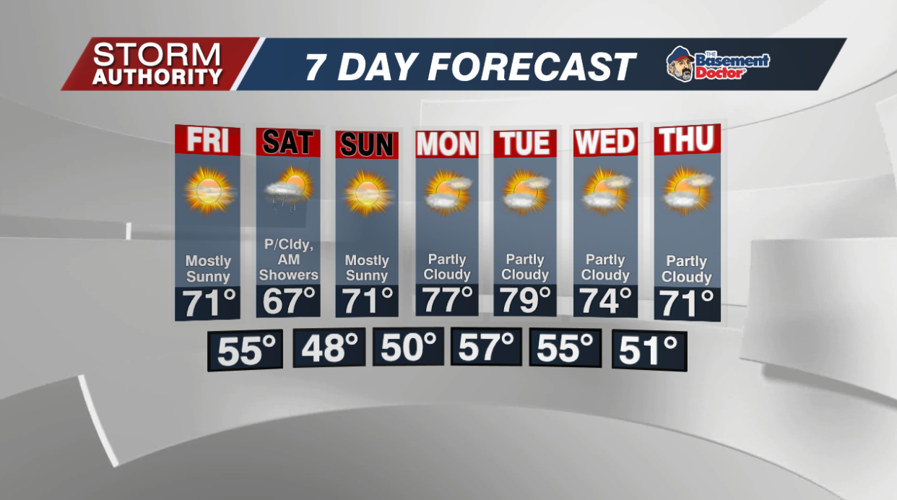
FRIDAY: A complete 180° change from the past several days. Expect bright and sunny weather with warmer highs near or just above 70°.

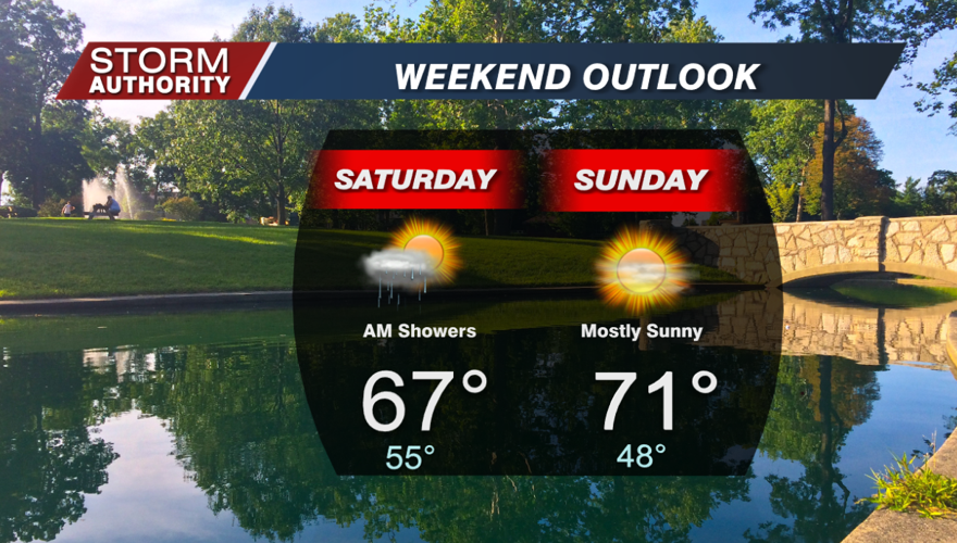
THE WEEKEND: A fast moving frontal system will bring a band of rain showers for Saturday morning. If this timing holds, it will clear out by the afternoon with sunshine building in. Sunday looks like a fantastic day with mostly sunny skies and highs in the low 70s.

NEXT WEEK: A beautiful weather pattern with a mix of sunshine and clouds each day. Highs should mostly range in the 70s. It appears a long dry stretch will settle in, just what the doctor ordered after the soggy past few days.


