
Thursday, February 24, 2022:
Snow showers are providing us a light coating of snow with some slick travel this morning. This activity will taper to flurries and diminish through the morning.
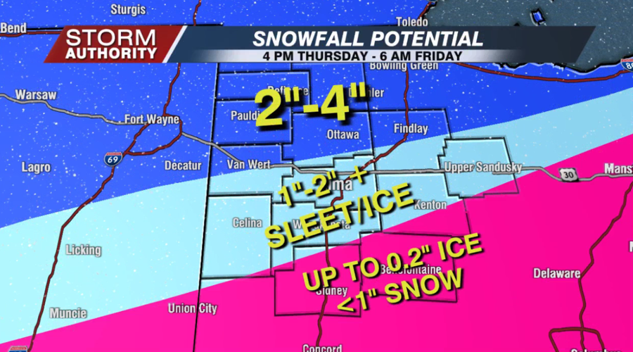
The main round of winter weather surges in this evening as a combination of snow, sleet, and freezing rain, generally after 4PM. The activity will continue overnight and taper off to a few flurries by sunrise Friday. While the "amounts" of wintry weather are not substantial, the impacts are high with slick and hazardous travel conditions for the evening and overnight hours.
The forecast remains on track for a 1-2" of snow/sleet combo around Lima with a glazing of freezing rain. Areas north of a Van Wert to Findlay line will see more of a snow event, but there could also be a little mixing there too. Our southern areas will see more of an ice event with icing amounts of 0.1" to 0.2" possible in the pink shaded area. Snowfall will be minimal for those areas.

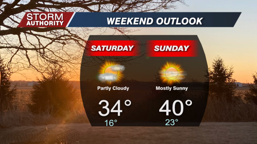
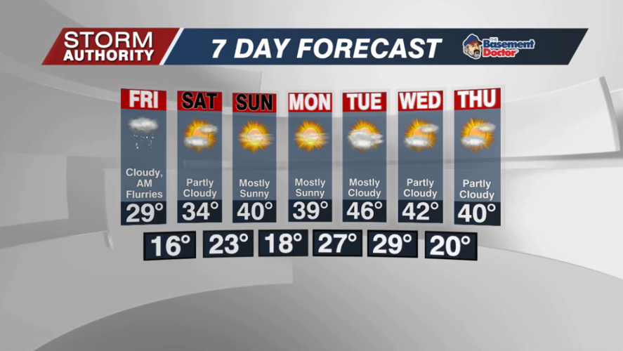
Flurries will gradually taper Friday, but a cloudy and cold day is expected. Finally, high pressure will work to give us some sunshine on Saturday. A warming trend sends temperatures close to 40° by Sunday, so much of our accumulation will disappear over the weekend.

Just what the doctor ordered, a stretch of dry days, sunshine, and seasonable temperatures is expected for much of next week as we kick off March.


