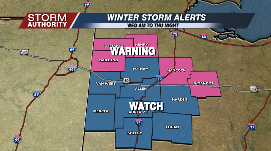

Winter storm watches were upgraded to warnings for our northern and northwest areas, where the winter storm is set to arrive during the day Wednesday. Lima is set to see the impactful winter weather arrive closer to Wednesday evening, with major impacts areawide on Thursday. Expect every single county to eventually get upgraded to the winter storm warning.

The system begins as rain tonight into Wednesday morning. By mid-morning Wednesday, the rain/snow line looks to stretch from northwest Van Wert county up through Henry county. That line makes a gradual dive southeast through the afternoon and evening. Most data indicates a transition from rain to wintry weather from late afternoon to early evening around Lima. Most of the area should see snow as the precipitation type overnight Wednesday and Thursday morning, but the mixing line may continue to hug our southern counties. Travel will become tricky and progressively worse through the night.
Thursday is the "peak" of our winter storm for Lima. At this point, the majority of the data shows the sleet/freezing rain concerns will remain south of our viewing area, meaning all snow here. That mixing line would be the only wrench to the snow forecast, so we will watch for any adjustments. Winds are forecast to pick up, with gusts reaching 25 to 35 mph by the afternoon. Blizzard-like conditions will be possible at times. Travel will be very difficult and quite dangerous.
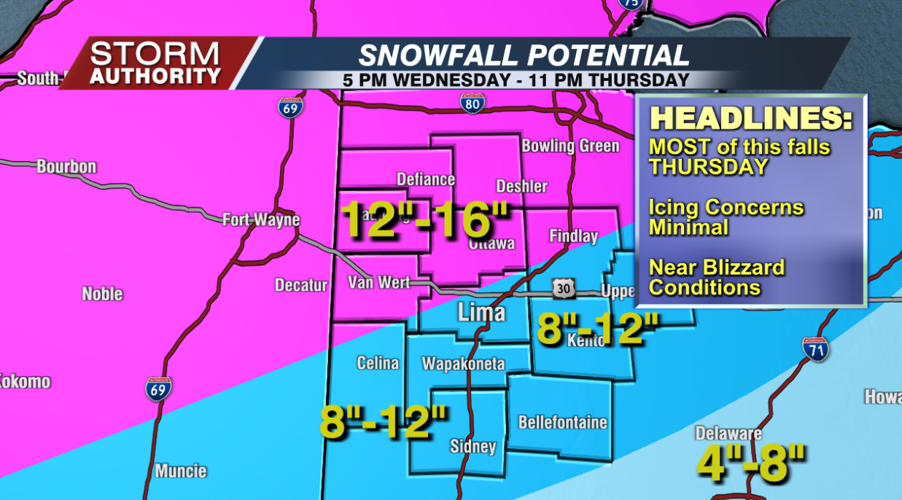
The big question, how much snow? There is rather high potential for 12"+ amounts to be measured in portions our area, particularly to the north. The minimum amount in our forecast is 8", with a maximum range up to 16". This is a major snowfall that only happens once every several years. Let's take a look at the time-line of how the amounts will fall.
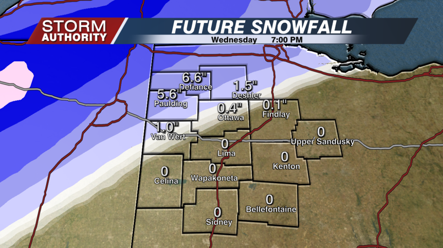
By 7PM Wednesday, amounts of 4 to 8" will have already fallen across our northwest zones, with very little at that point in Lima.

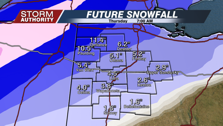
By 7AM Thursday, totals will range from 5-10" northwest, 2-5" around Lima, with lower amounts southeast.

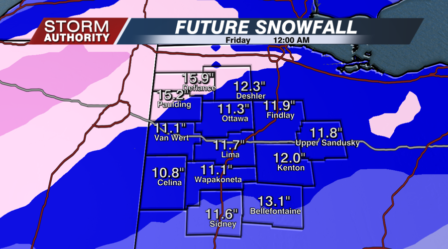
By 12AM Thursday, most areas will have received at least 10", with totals reaching well over a foot in our northwest areas. Snow will taper to flurries by that point and exit the area overnight.

Here is our official snowfall forecast.

Stay tuned to your Storm Authority as we continue to monitor the storm and update the timing and amounts.


