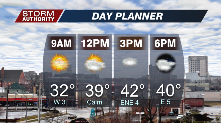

Our weather has returned closer to reality for December! Temperatures are starting off around 30°, but will recover to the lower half of the 40s for the afternoon. The bright sunshine to start gives way to a cloudy afternoon. A spotty shower cannot be ruled out toward sunset.

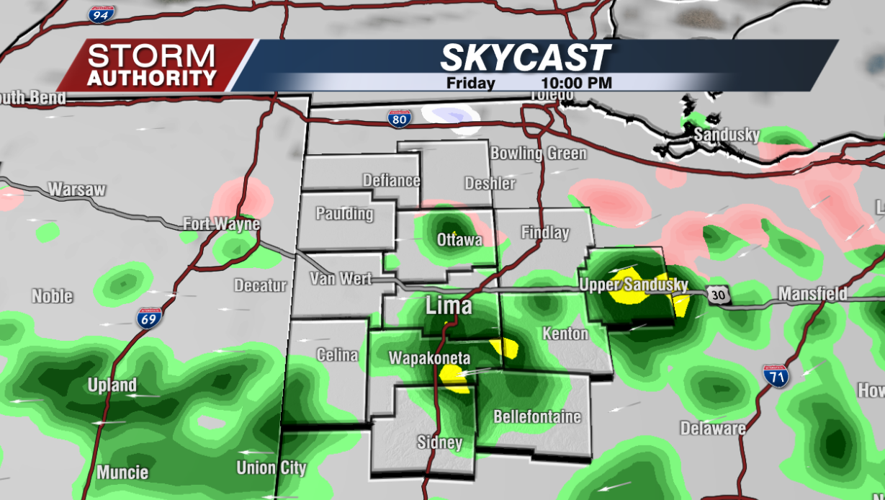
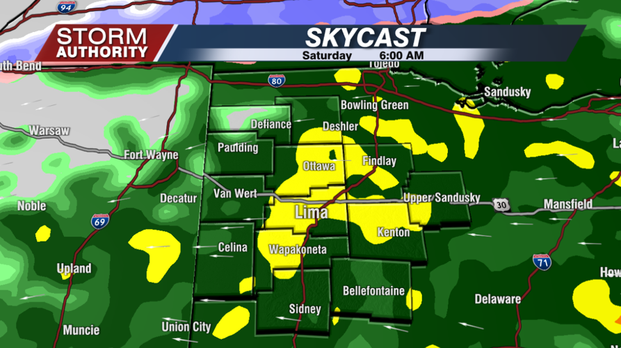
Heading out this evening? It wouldn't be a bad idea to bring along the rain gear. Spotty showers should move in, gradually increasing later in the evening. After midnight, rainfall becomes widespread. Temperatures will hold steady in the middle to upper 30s.


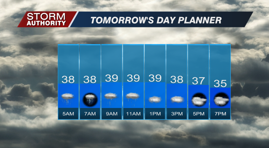
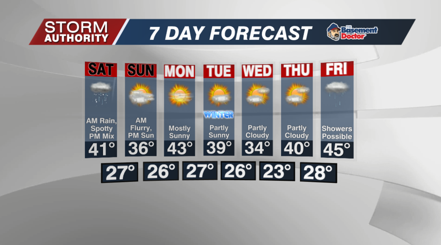
Saturday gets off to an ugly start with cold rain showers across the area. That rain activity sticks around through noon, then moves out. A mostly dry afternoon, but spits of snow flurries and brief rain will remain possible under a gloomy sky. Highs briefly hit the low 40s early, then drop into the middle 30s for the afternoon.

Flurries are possible Saturday night into Sunday morning, but little to no accumulation. Clouds gradually give way to some sun Sunday, but it's a chilly day with highs in the middle 30s.
The good news is most of next week is very quiet. In fact, we should see a decent amount of sunshine each day through Thursday! Temperatures fluctuate in the 30s and 40s for highs. Our next system may bring precipitation for Christmas Eve. The GFS model has a band of wet snow, while the European model is much warmer with rain. Perhaps that leaves small hope for a white Christmas, but it looks rather doubtful.


