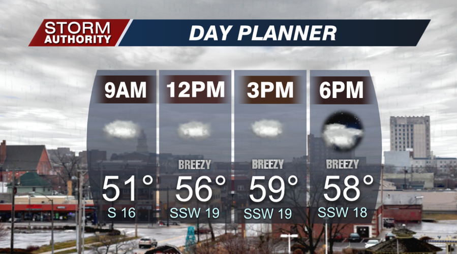

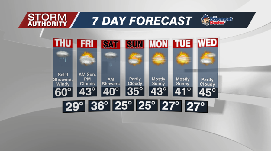

There's nothing like a 50° mid-December morning! The weather only gets warmer from here as afternoon highs flirt with 60° in spots! The trade off is a cloudy day with a few hit or miss showers. The chances of rain are very low for the afternoon. It will be quite breezy as gusts hit 30mph later in the day.

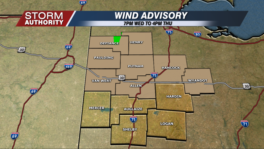
It goes from breezy to downright windy tonight! A wind advisory goes into effect at 7pm. Gusts at times overnight could hit 40 to 50mph. The higher gusts will be found to the north, and after midnight. Temperatures will hold steady in the middle 50s.

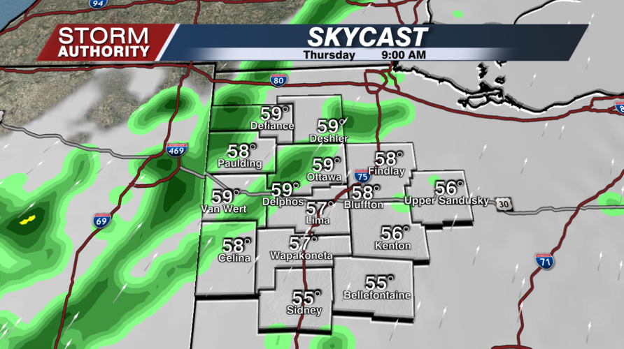
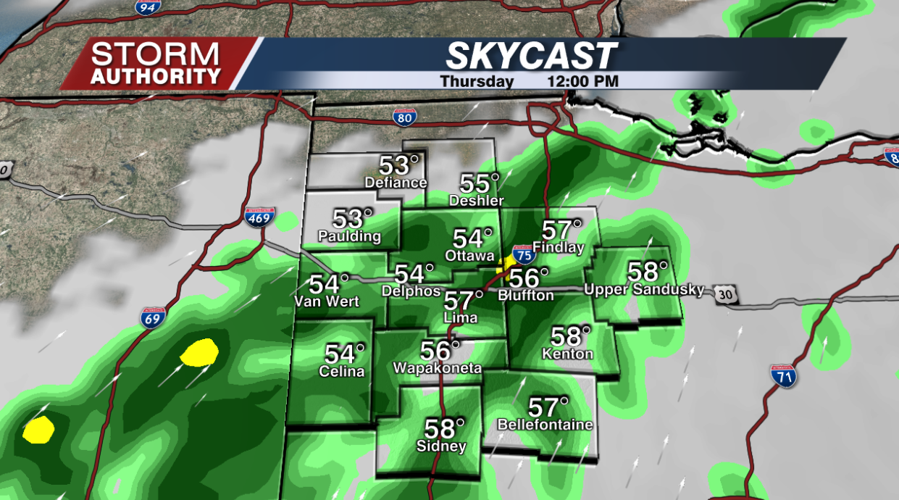
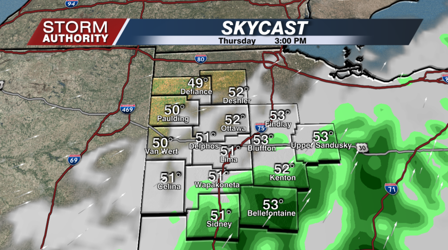
The winds will continue to whip around on Thursday, but gradually decreasing by midday and especially the afternoon. Expect scattered showers to hit the area after sunrise, with showers continuing through about 3PM.


Friday is MUCH cooler with morning lows in the upper 20s. The day starts sunny, but turns cloudy rather quickly as a system approaches from the south. Highs should hit the lower to middle 40s.

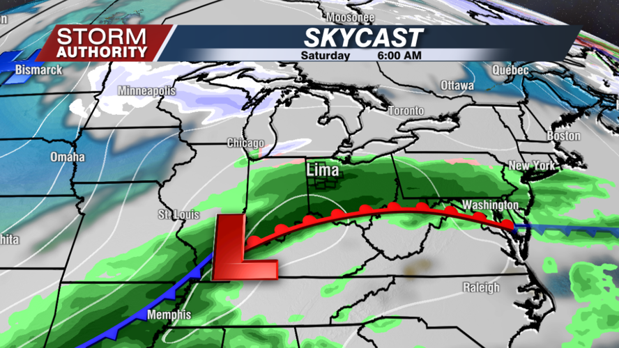
Showers are forecast to arrive Friday night and last through the first half of Saturday. A snowflake here or there is possible, but generally it's just a cold rain. Highs on Saturday hold in the upper 30s to 40°.

The extended forecast is trending sunnier for next week! A cold day on Sunday, but it looks like a rebound to highs between 40-45° for the first half of the week. It does appear a cold front arrives late next week. This may bring a little rain to brief snow, then more seasonable air (highs in the 30s) in time for Christmas. No "major" systems are showing up during this period.


