
Friday, March 4, 2022:
Our Friday morning is starting off very chilly with temperatures in the 20s. Expect a quiet day with minimal wind and partly sunny skies. Afternoon highs will rebound into the middle 40s, very close to our normal high.
Not anywhere as cold tonight due to increased clouds and a light southeast breeze. Lows fall into the middle 30s.
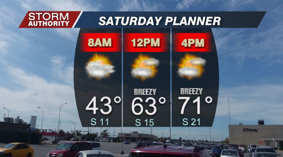
Clouds will give way to partly sunny skies on Saturday. Southerly winds will become breezy by the afternoon with gusts up to 30mph. Temperatures will warm in dramatic fashion. Below is a look at your Saturday day planner. Our forecast high is 71° for Lima!

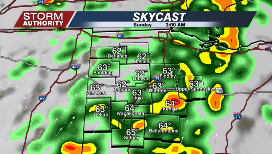
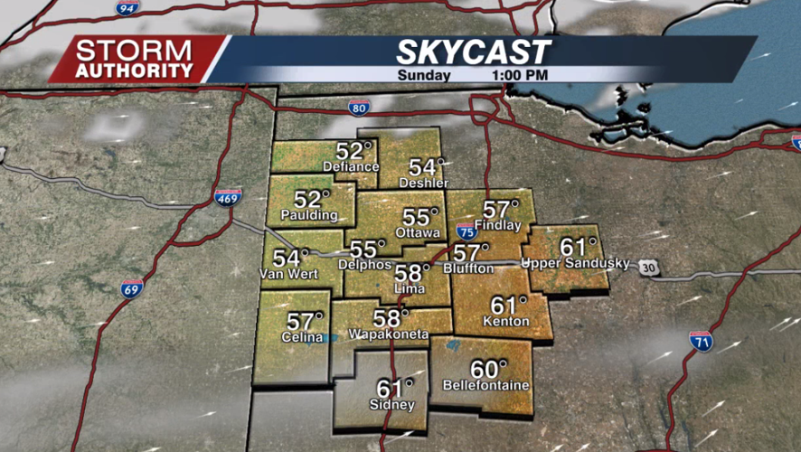
Dry weather continues Saturday evening, then a scattering of downpours will work over the area between midnight and sunrise early Sunday. This activity will clear out with a mix of sunshine and clouds along with gusty winds. Temperatures will fall gradually from the 60s in the morning to the upper 50s for the afternoon. All in all, this is a fantastic weather weekend for early March!


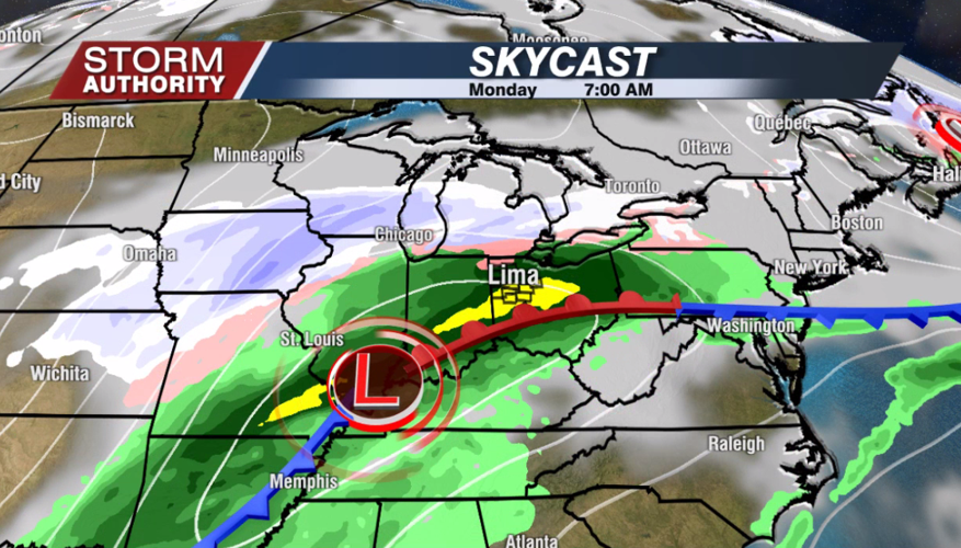
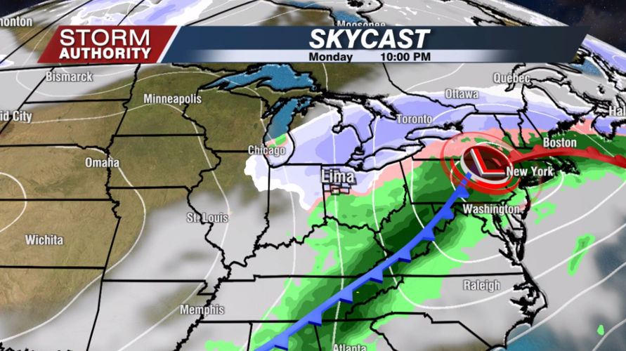
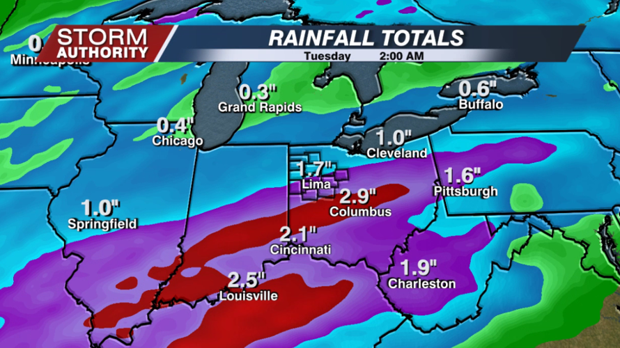
Widespread rain arrives after midnight Sunday night, lasting for much of our Monday. The rain may mix and chance to snow showers late Monday afternoon into the night as colder air wraps in. Currently, the bulk of sticking snow is expected to stay north across Michigan. However, a brief, light accumulation cannot be ruled out. We will keep you updated over the weekend. Rain totals look to exceed 1" for many, with our southern areas approaching 2".


High temperatures will remain cooler and close to the normal next week (40s to 50), with quiet weather midweek. A very strong cold front is showing up around next Friday. This could bring a chance of rain going over to snow, then bitterly cold air is possible next weekend. Right now, the forecast is for highs in the upper 20s with snow showers next Saturday. Lower teens are expected for the lows by next Sunday. Let's hope this all changes, but right now it looks very wintry for the Lima Irish Parade. The cold peaks next weekend, then gradually eases during the following week.


