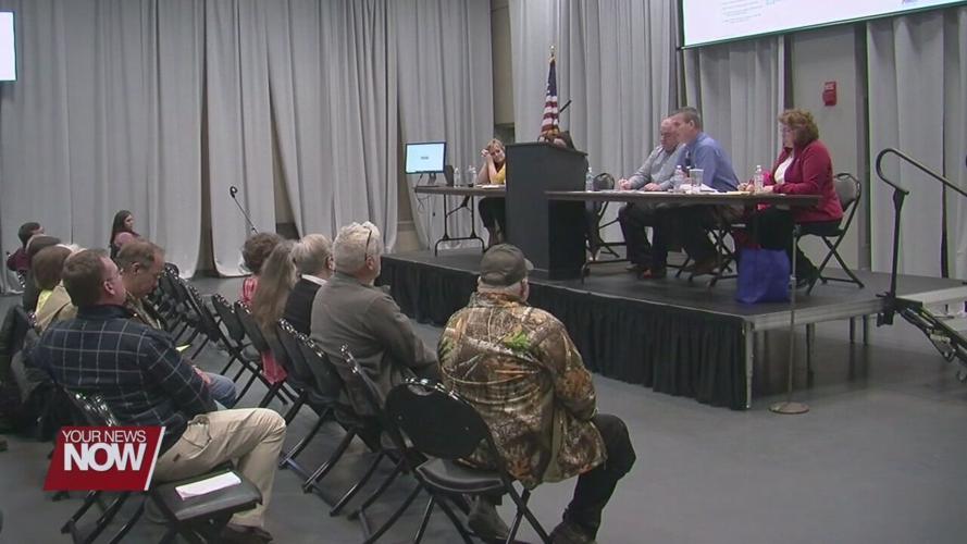
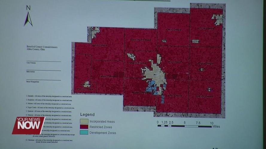


Allen County commissioners invited the public to view the new wind and solar development map that they created.

Creating the map has been a process months in the making as the commissioners met with township trustees for input on which areas renewable energy development could be done in Allen County. The map is also a result of Senate Bill 52, which has given more control to local authorities to figure out if their county is open for business to wind and solar industries.

Monday night's hearing allowed the public to view the drawn-up map and see where wind and solar development would be done. People could also voice any concerns they had before the commissioners voted to adopt or discard the new map.
"I think that it goes too far," said Dawn Budd. "I think that in the future there’s going to be a desire in this community for development, and the restriction of that development is not something that the citizens need."
"50 megawatts and less renewable energy development can still come into the county, and that’s a facility that is big enough to power 9,000 homes," said Jim Thompson. "So, I think this map is a good compromise to keep larger industrial-sized utility companies out, but still allow for investment in renewable energy."
Ultimately the commissioners voted in favor to adopt the map, but they say that this layout is not set in stone and that the commissioners can revisit the map in the future.
"Any action taken, there could be other actions by the commissioners either this year or in the future if there’s any alterations that need to be made," said Allen County Commissioner Cory Noonan. "At this time, this was the map that we believed was best for Allen County."
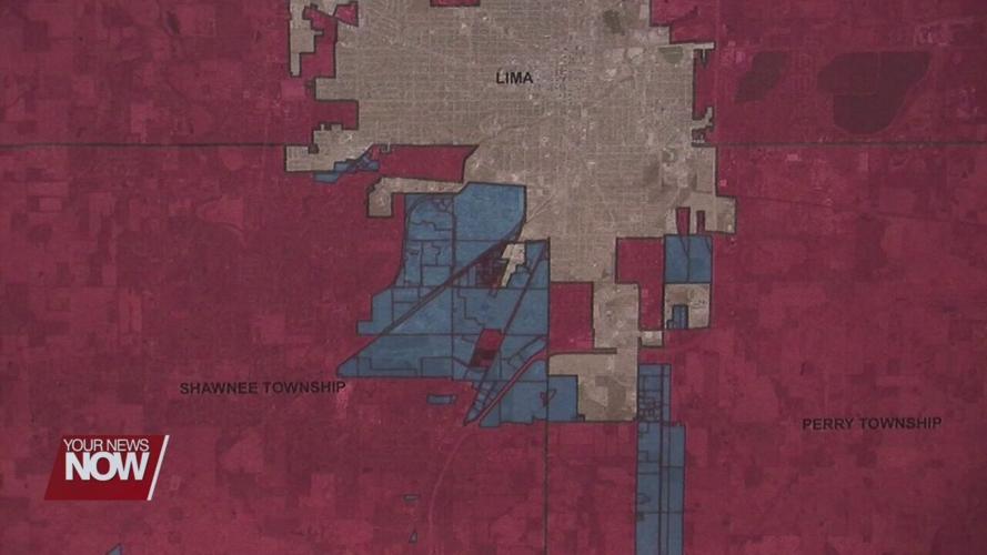
The map designates the development sites as two industrial parks in Shawnee and Perry townships.


