
After a round of spring storms Wednesday, spring is taking a backseat to winter as we head into the upcoming weekend. We even have a chance to see some flakes flying around.
Thunderstorms produced hail of nickel to quarter size in the Elida area Wednesday afternoon. Check out this photo from Andrew Dunahay.
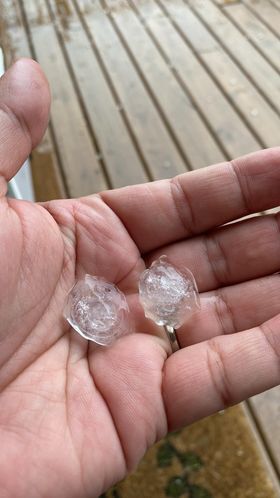
Nickel to quarter size hail in Elida, courtesy of Andrew Dunahay.
A beautiful rainbow appeared after the storms in Bath Township, courtesy of Lynn Moore - Swartz.
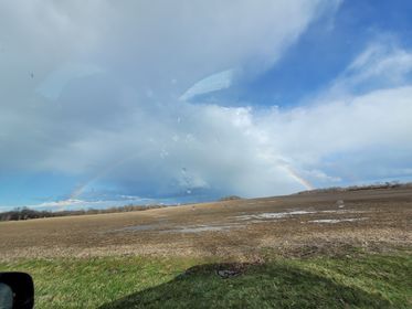
Photo courtesy of Lynn Moore - Swartz.
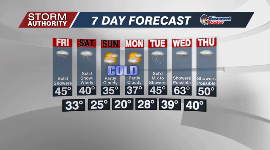
A mostly cloudy but drier day today with a few brief passing showers. Highs will top out in the upper 40s and lower 50s.
A drier slot of air may give us some sunshine toward sunset, with some partial clearing through midnight. The thick clouds return by Friday morning with a spotty shower or two. Lows tonight settle to around 40°.
Friday is a chilly, gloomy day with a few scattered showers around. The greatest shower chance is later in the day into the evening. Scattered showers transition to snow showers after midnight Friday night into Saturday morning. Lows settle near to slightly above freezing.
Expect a windy, cloudy, and cold Saturday. Scattered snow showers are possible, mainly during the morning. Temperatures will struggle to get out of the upper 30s.
Sunday and Monday bring some welcomed sunshine, but temperatures will be January-like! Expect highs in the 30s, with lows possibly hitting the teens for some Monday morning. These numbers are about 20° below normal!
For now, our next precipitation threat arrives Tuesday. Temperatures may be cold enough in the morning for a wintry mix. It warms rather dramatically by Wednesday with more showers, then a fast return to cooler than normal air late in the week.


