

(WLIO) - The cooler temperatures are just in time for autumn's arrival. Our Nathan Kitchens spoke with the National Weather Service to see how the season may unfold.

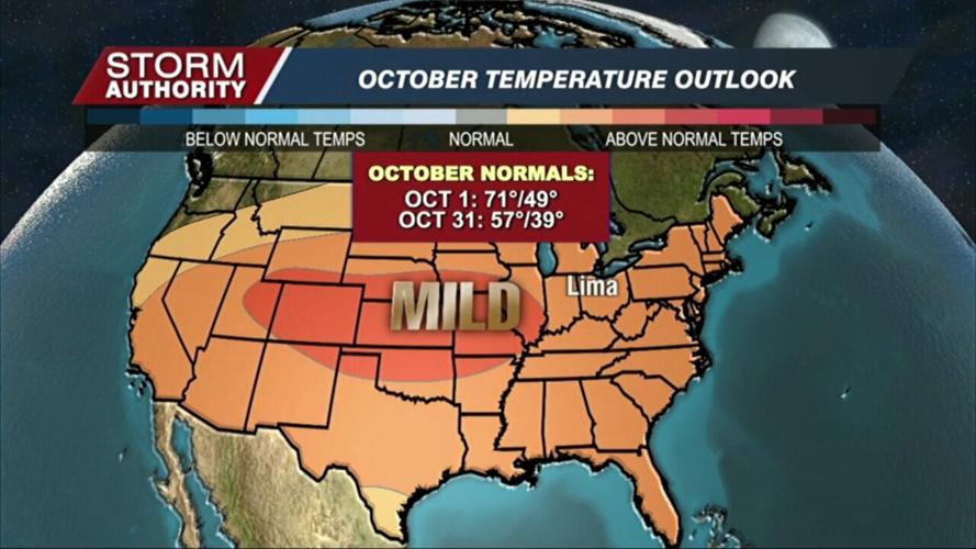
It would seem Mother Nature is right on cue in delivering the first real taste of fall just in time for the fall equinox. The forecast is for below-normal temperatures for late September, but what about the rest of the season?
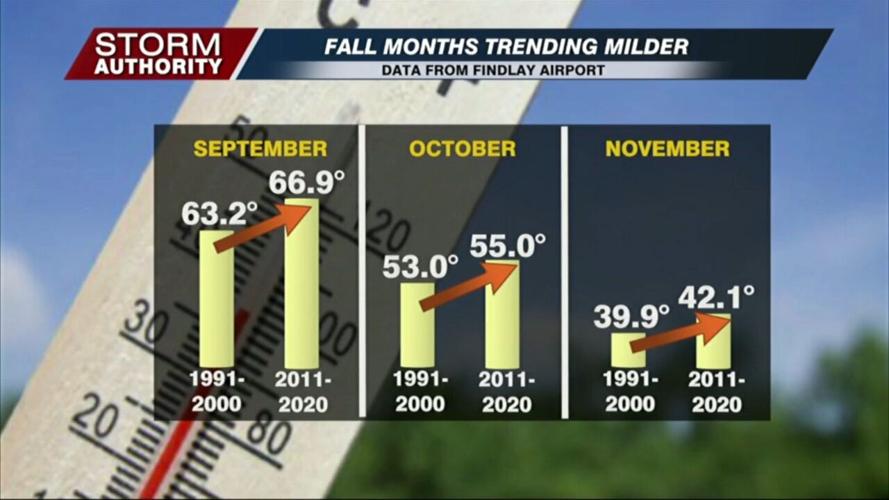
Looking over recent weather trends can be valuable to predict the future. The fall months have seen a consistent warming trend over the past several decades, with September seeing a jump of almost 4° in the last 30 years.

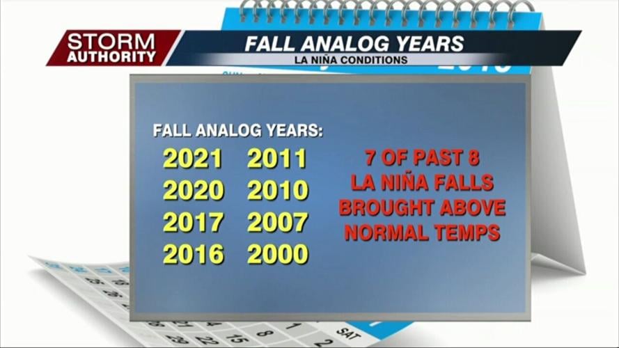
For this year, La Niña continues to play a role in the global weather pattern. Over the last eight La Niña falls, seven of them ended up warmer than normal here in northwest Ohio. It should be no surprise that the current forecast models suggest a warmer autumn, but probably not to the record warm pace of last year.

"The tendency will definitely be to the above-normal side, but I don't think as much as last year. We had a lot of 90s into the first half of October last year. It does not look as warm as last year, though," commented James Noel, hydrologist from Wilmington, Ohio.
La Niña is just one of several influences on the weather pattern. The activity in the tropics will need to be watched as that can have impacts on a global scale.
"One of the things this time of the year that really affects the weather patterns across North America is really all of these hurricanes in the Atlantic and typhoons in the Pacific that interact with the jet stream that changes the weather patterns, so that's also another big factor," explained Noel.
All of that said, signs point to favorable harvest conditions for area farmers this year.
"Since I think we're right now shaping up to be a little bit on the drier side in October, once those crops mature completely, they should be able to get in and have a pretty good access to it so it will probably move along pretty quickly I would think," said Noel.
Noel says northeast sections of the state may be the one area to watch for localized wetness when cooler air masses come off the warmer lake waters.


