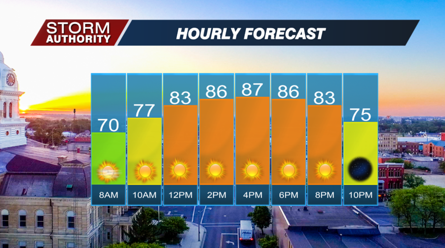
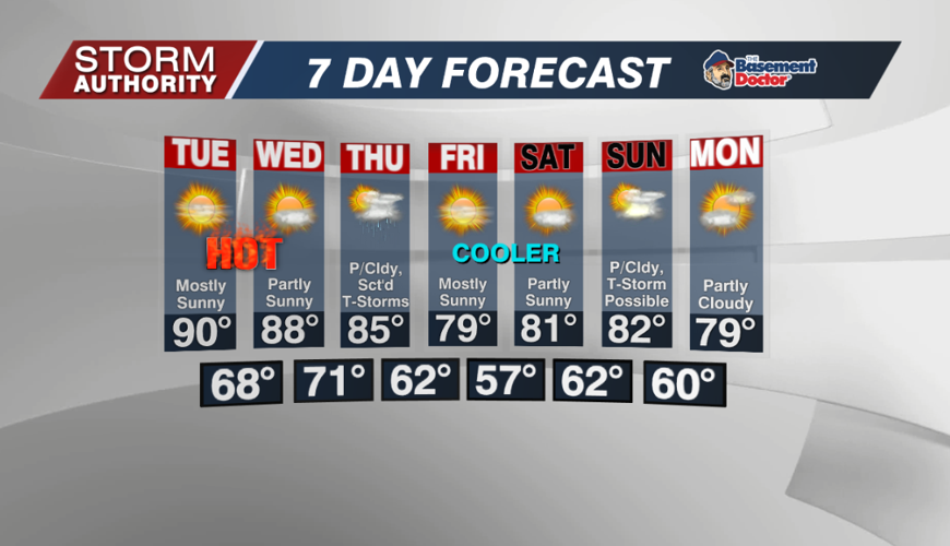

Our Monday is off to a bright and warm start with sunny skies. Expect sunny conditions throughout the day with highs reaching the upper 80s. The difference from Sunday is that it will not be anywhere as humid, making the heat more bearable.

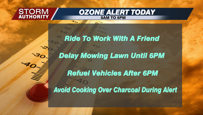
The stagnant air and heat create increased ground-level ozone, and that combined with air pollution leads to lower air quality. As a result, an ozone alert is in effect for Allen County from 8AM to 6PM. If you have asthma, you will want to limit duration outdoors, particularly during the hottest points of the day.
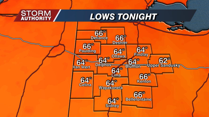
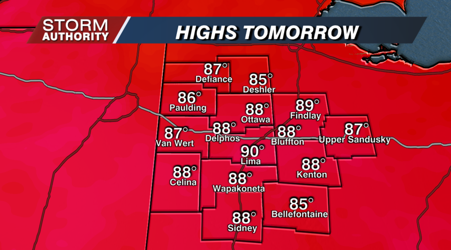
The good news is that temperatures will be able to dip into the middle 60s tonight, giving us some relief from the heat. Highs on Tuesday should recover to 90° with mostly sunny skies. The heat continues Wednesday, and humidity levels will build by then.


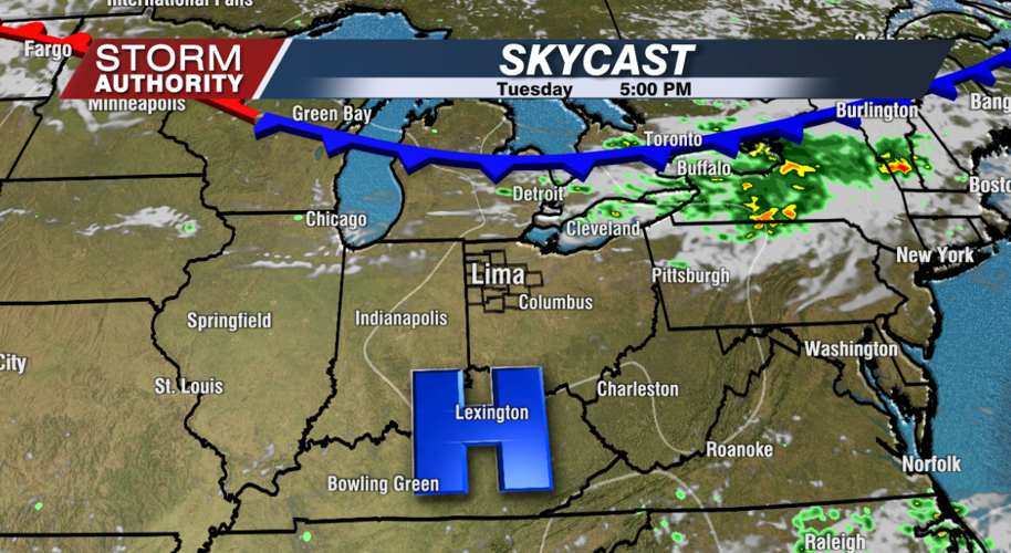
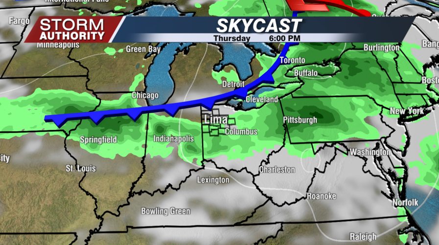
Some data is suggesting a cluster of storms may try to work through late Wednesday night into early Thursday. If that can materialize, we could talk about localized severe weather with gusty winds. Some scattered storms are expected Thursday as a cold front passes.

Friday looks fantastic as much drier and more comfortable air settles in. A secondary front arrives by Sunday with a storm or two, followed by another shot of pleasant temperatures to begin next week.


