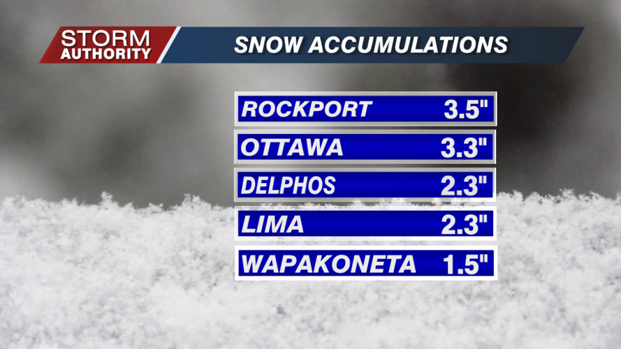


It took until late January, but the first widespread snow event of the winter swept across the area on Sunday. Totals generally ranged from 1-3", with isolated higher totals north.

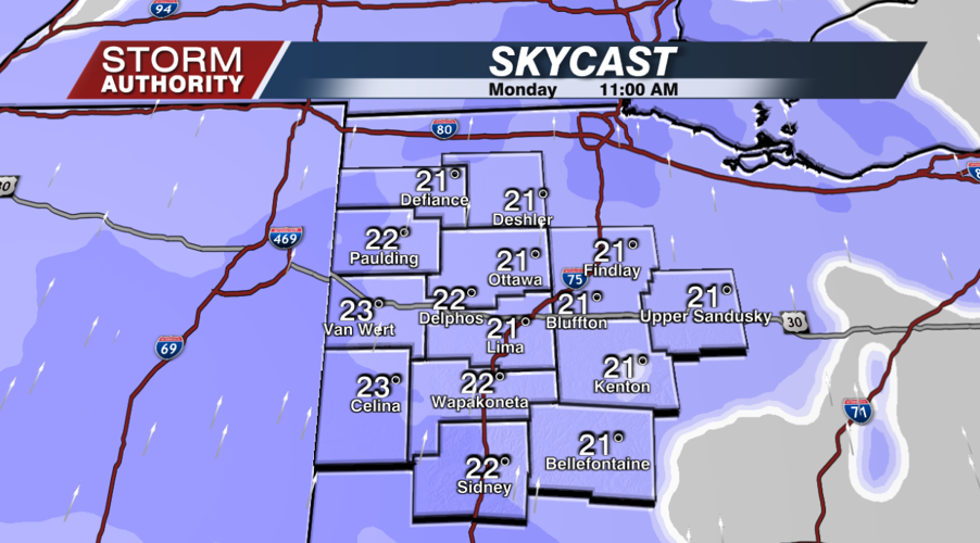
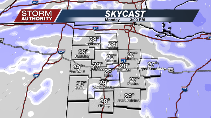
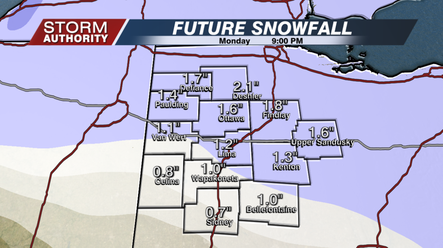
Another snow event quickly works in today. Flurries will increase to a steady, light snow by mid-morning, with the steadiest snow prior to 3PM. Snow will taper to scattered flurries or light snow showers for the middle afternoon to the early evening. Most of the area can expect a fresh 1-2" of snowfall. Allow extra time for your travels today!


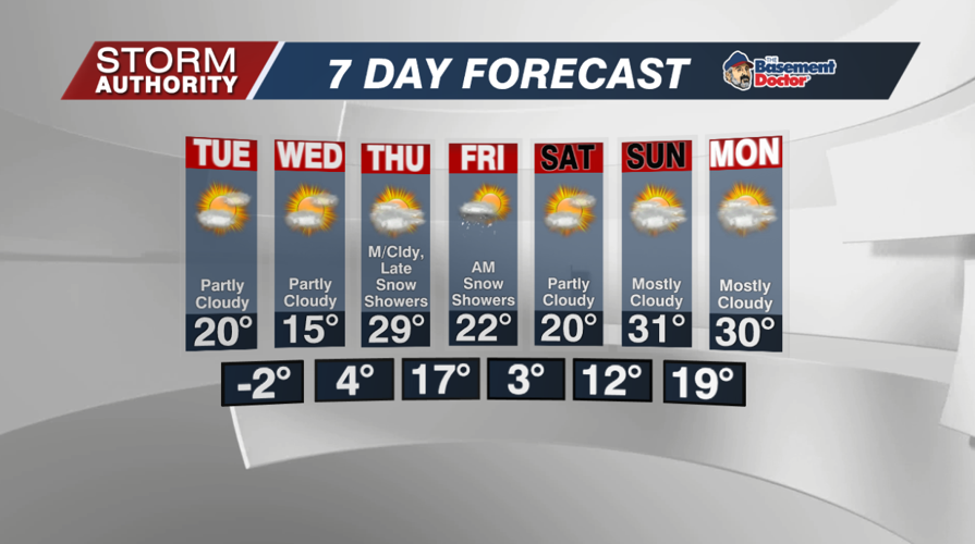
The big headline after today is the cold! Now that a snowpack is established, we are talking about lows dropping below 0° by Tuesday night. Overnight lows briefly jump on Thursday night, then one more cold blast drops lows close to 0° again Saturday morning. The only other chance of snow arrives Thursday evening into Friday morning. Right now, it looks minor at best.

LONG RANGE: All indications indicate a flip in the weather pattern for February. After a January that was cold and very dry in Ohio, February looks very active with large temperature swings. This is the type of pattern that can have us going to the 50s one day and 10s the next. This will also fuel larger storms that can bring everything from rain, ice, and even larger snows. One thing for sure, it doesn't look boring!


