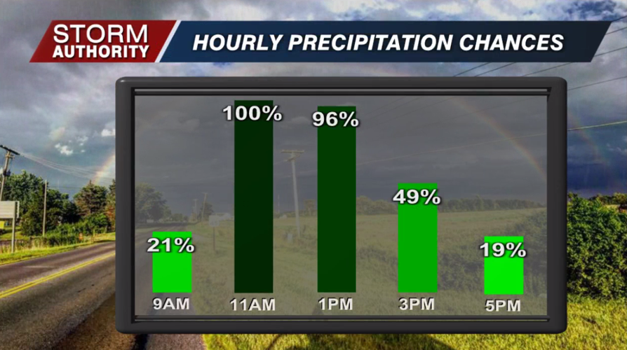

A soggy start this morning as rounds of moderate rainfall will continue lifting into the area through early afternoon. Watch out for flooding and ponding of water when traveling. The best chance of rain is prior to 2PM. Gaps of drier weather should build in later today. Highs will warm to near 60° with breezy southerly winds.

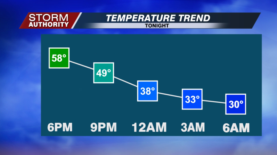
The cold front will cross the area around 7PM with a few additional showers, then breezy and dry weather builds in overnight. Watch the temperatures plummet.

A quiet and chilly Wednesday with highs struggling to crack the freezing mark under mostly cloudy skies.
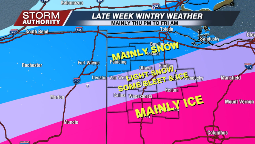
More precipitation is slated to arrive later this week, this time as a mixture of sleet, freezing rain, and snow. We are not expecting a major storm at this time, but high travel impacts will be a sure bet. Here is a breakdown of current thinking:
-A weak wave of snow showers will be possible from midnight Wednesday night to 9AM Thursday, especially south of Lima. Minor accumulation under 1" will be possible with this wave, but some areas will miss out.
-A break will develop and last for a decent chunk of the daytime Thursday with dry skies. The bulk of the moisture arrives after 4PM and sticks around into Friday morning. For many areas, it looks like a mix of light sleet, snow, and freezing rain, then ending as snow as it exits Friday morning. Our northern areas look to stay mainly snow, while our southern areas look to be more freezing rain/sleet dominant with little or no snow. The data shows higher precipitation totals to the south, so the areas that see mostly freezing rain could see light to even moderate ice amounts.
-We will discuss accumulations as we get closer. I would not look for a whole lot of snow in Lima due to the potential mixing issues with sleet and possibly some freezing rain - similar to last week's event. The complicated part is the northern areas will see less moisture with this storm despite seeing mostly snow, so big amounts are looking unlikely. The higher moisture is displaced to the south where the precipitation falls more as freezing rain, so central Ohio could see the worst impacts from this storm due to a freezing rain event.
-Regardless of how much, travel impacts are likely for Thursday evening, night and through Friday morning. Conditions should quickly improve for Friday afternoon/evening plans.


