

LIMA, OH (WLIO) - What weather event sticks out the most from 2022? Meteorologist Nathan Kitchens recaps our past year of weather.

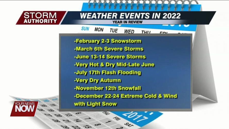
Although a new year has begun, we are taking a look at the weather events that made 2022 memorable. For the third year in a row, we're happy to report that no major tornadoes touched down in our area. However, the list of impactful weather events remains rather lengthy.
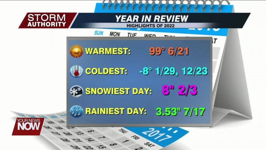
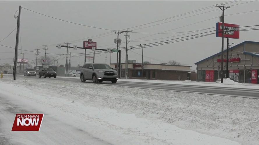
Moving in chronological order, our first major event was a winter storm on February 2nd and 3rd. The storm dumped 6" to 10" of snow, following a period of rain that froze on area roadways. This would end up as our only notable winter storm last winter.

The spring storm season was relatively tame, but the most significant severe weather would move through on June 13th and 14th. While Lima ended up largely spared, severe storms were numerous north and south of the city where 60 to 70 mph thunderstorm gusts were common. This downed several trees and power lines.
What followed the storms was an intense heat wave. Highs in the 90s coupled with high humidity produced a heat index up to 110. Many left without power from the storms were forced to visit local cooling centers.

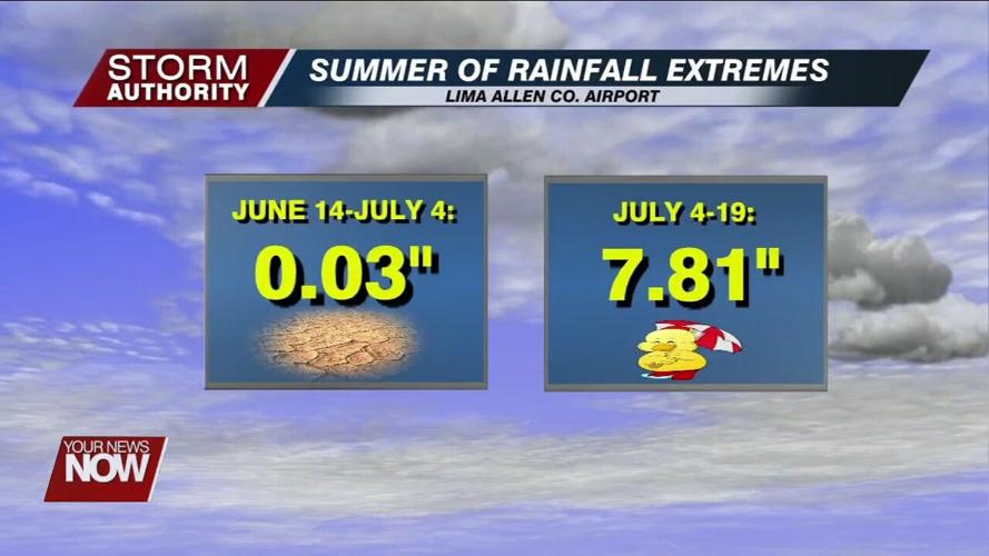
A cold front would briefly bring major relief our way, but it didn't last long. Additional surges of extreme heat continued through early July. The heat also came with a dramatic shut-off in rain. The area would go the second half of June into early July with nothing more than a couple of sprinkles. This raised drought concerns as area lawns and gardens struggled.

A welcome pattern change in July would douse drought concerns. A few soaking rainfall events allowed area lawns to turn lush and green, and area crops received a drink during a critical stage of development. On July 17th, too much rain caused localized high water issues on area roadways.
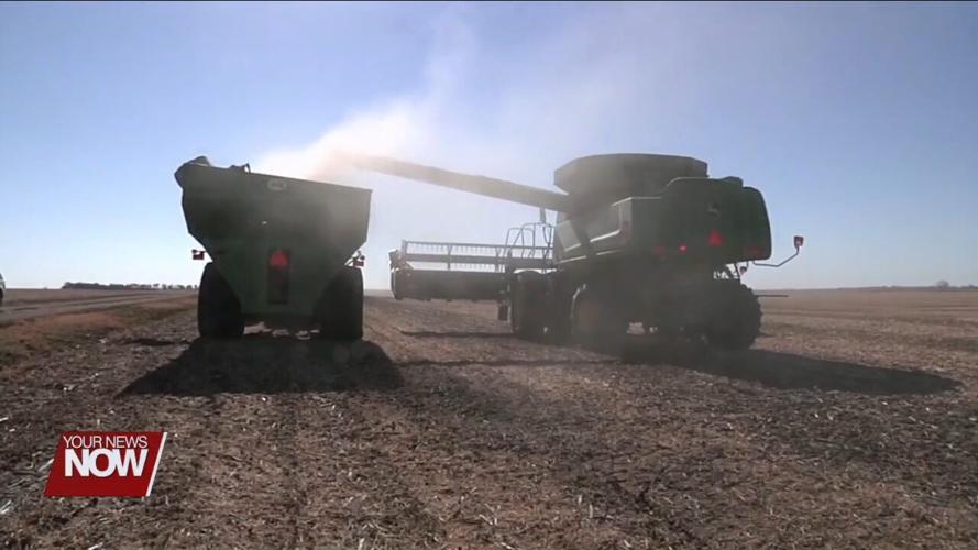
After a seasonable August and early September, the tap shut off dramatically with unusually dry conditions from late September to late November. A single rain event over two-tenths did not occur for over two months. The relief is that the drought was too late to have a major crop impact. The dry period also allowed for ample sunshine and the most favorable harvest weather pattern in recent memory.
Arguably, the most interesting event was the arctic blast that swept the country right before Christmas. Temperatures dropped nearly 50° in the span of ten hours. This front set a new December record for the most dramatic temperature drop in such a short time frame. The high on Christmas day was the coldest since 1985. While only a couple of inches of snow fell along the arctic front, extreme cold and high winds made travel very difficult. To add to the complications, a flash freeze occurred and caused an icy layer on area roadways.
As we usher in 2023 with a chance of thunderstorms and record highs, Mother Nature is sure to have many surprises up her sleeves this year. And don't forget that you can find our weather app by searching "YNN Weather" in your device's app store.


