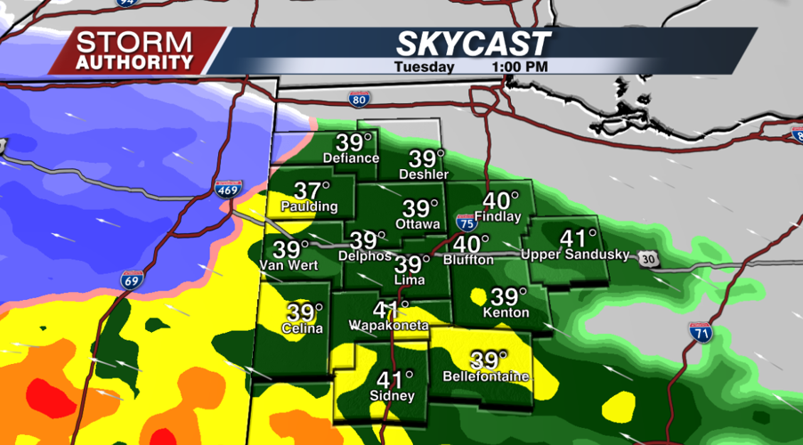
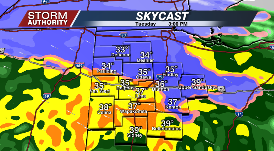
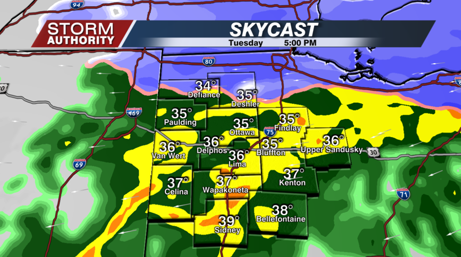
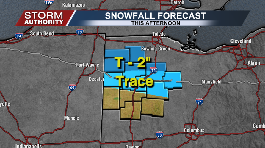
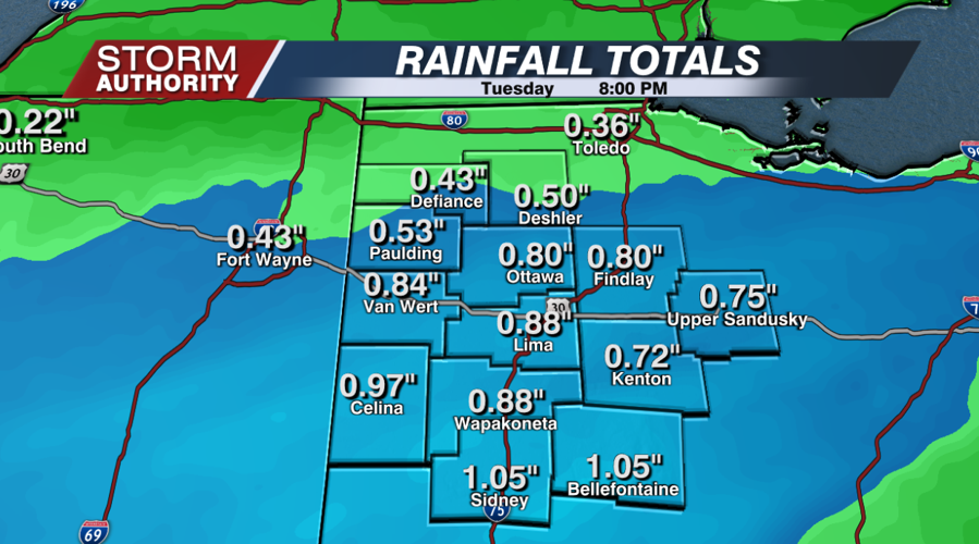

All is quiet to start this Tuesday morning, but that will quickly change as the day progresses. A significant influx of moisture will produce widespread precipitation for the afternoon, falling heavily at times. It initially starts as rain around noon, but "dynamic cooling" will cause part of the area to switch to heavy, wet snow around 2-4pm, mainly Paulding to Bluffton and north. Eventually, it will go back to rain there by early evening before ending around 7PM. Anywhere from a trace to 2" of snow could fall north of U.S. 30, with best chances for up to 2" snow totals around Defiance to Napoleon. For Lima and many areas, the bigger concern today is possible flooding from too much rain. Flooding will develop in low-lying and poor drainage areas.


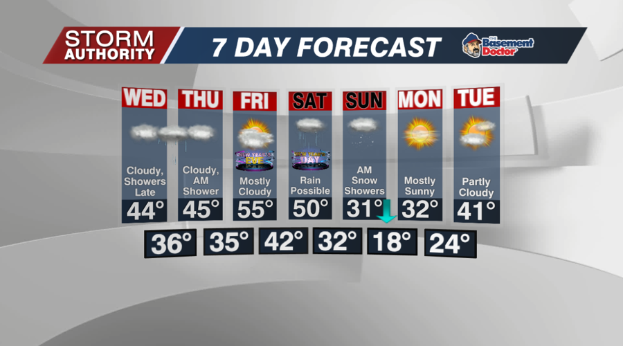
Finally, dry weather will return by mid-evening. Some patchy drizzle and fog could develop very late tonight. Temperatures hold rather steady in the middle 30s.
Wednesday will start with patches of fog or drizzle, otherwise a rather quiet day with the clouds sticking around. Highs will be above normal into the low and middle 40s.
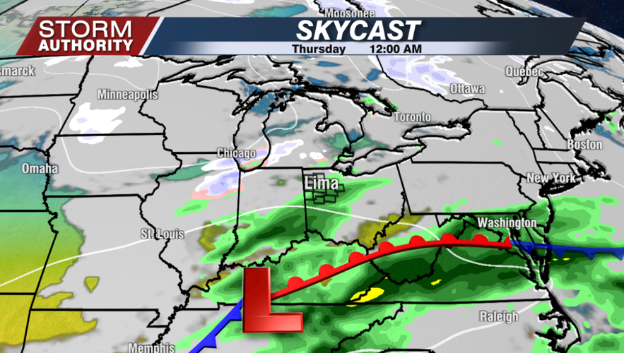
A weaker wave will bring scattered showers Wednesday night, with a shower or two possibly lingering Thursday morning.

A southerly flow will cause temperatures to go way above normal again by New Year's Eve into the middle 50s! A storm system brings rainy weather for Saturday, then a very sharp temperature drop Saturday night with the rain going over to snow showers. Temperatures will fall into the 20s during the day Sunday, with middle to upper teens for Monday morning. Another rebound in temperatures is expected by Tuesday with a dry pattern early next week.


